Long Range Thread 9.0
+51
Sparky Sparticles
track17
Grselig
snowday111
2004blackwrx
Joe Snow
GreyBeard
devsman
Mathgod55
deadrabbit79
jimv45
Taffy
Biggin23
crippo84
SNOW MAN
lglickman1
Dtone
Artechmetals
Dunnzoo
Vinnydula
Bkdude
SoulSingMG
oldtimer
Quietace
billg315
Math23x7
snow247
jake732
rb924119
Snowfall
Abba701
nutleyblizzard
Radz
RJB8525
justin92
chief7
hyde345
weatherwatchermom
CPcantmeasuresnow
frank 638
HectorO
Snow88
jmanley32
sroc4
skinsfan1177
algae888
amugs
docstox12
Frank_Wx
NjWeatherGuy
dsix85
55 posters
Page 28 of 40
Page 28 of 40 •  1 ... 15 ... 27, 28, 29 ... 34 ... 40
 Re: Long Range Thread 9.0
156 crawling I mean crawling up the coast ne
amugs- Advanced Forecaster - Mod

- Posts : 15157
Join date : 2013-01-07
 Re: Long Range Thread 9.0
162 still crushing us out at the BM now
amugs- Advanced Forecaster - Mod

- Posts : 15157
Join date : 2013-01-07
 Re: Long Range Thread 9.0
168 still going pulling away at this point
_________________
Mugs
AKA:King: Snow Weenie
Self Proclaimed
WINTER 2014-15 : 55.12" +.02 for 6 coatings (avg. 35")
WINTER 2015-16 Total - 29.8" (Avg 35")
WINTER 2016-17 : 39.5" so far

amugs- Advanced Forecaster - Mod

- Posts : 15157
Reputation : 213
Join date : 2013-01-07
Age : 54
Location : Hillsdale,NJ
 Re: Long Range Thread 9.0
174 sliding out past MV but still going here
_________________
Mugs
AKA:King: Snow Weenie
Self Proclaimed
WINTER 2014-15 : 55.12" +.02 for 6 coatings (avg. 35")
WINTER 2015-16 Total - 29.8" (Avg 35")
WINTER 2016-17 : 39.5" so far

amugs- Advanced Forecaster - Mod

- Posts : 15157
Reputation : 213
Join date : 2013-01-07
Age : 54
Location : Hillsdale,NJ
 Re: Long Range Thread 9.0
Nuts
GEFS look very good as well to great.
GEFS look very good as well to great.
_________________
Mugs
AKA:King: Snow Weenie
Self Proclaimed
WINTER 2014-15 : 55.12" +.02 for 6 coatings (avg. 35")
WINTER 2015-16 Total - 29.8" (Avg 35")
WINTER 2016-17 : 39.5" so far

amugs- Advanced Forecaster - Mod

- Posts : 15157
Reputation : 213
Join date : 2013-01-07
Age : 54
Location : Hillsdale,NJ
 Re: Long Range Thread 9.0
THIS IS SICKKKKKK FOR EPS ARE U FN KIDDING ME !!

_________________
Mugs
AKA:King: Snow Weenie
Self Proclaimed
WINTER 2014-15 : 55.12" +.02 for 6 coatings (avg. 35")
WINTER 2015-16 Total - 29.8" (Avg 35")
WINTER 2016-17 : 39.5" so far

amugs- Advanced Forecaster - Mod

- Posts : 15157
Reputation : 213
Join date : 2013-01-07
Age : 54
Location : Hillsdale,NJ
 Re: Long Range Thread 9.0
For that matter the GEFS have 3 other storm signals after this beast!!
_________________
Mugs
AKA:King: Snow Weenie
Self Proclaimed
WINTER 2014-15 : 55.12" +.02 for 6 coatings (avg. 35")
WINTER 2015-16 Total - 29.8" (Avg 35")
WINTER 2016-17 : 39.5" so far

amugs- Advanced Forecaster - Mod

- Posts : 15157
Reputation : 213
Join date : 2013-01-07
Age : 54
Location : Hillsdale,NJ
 Re: Long Range Thread 9.0
The EPS are making me tear
_________________
_______________________________________________________________________________________________________
CLICK HERE to view NJ Strong Snowstorm Classifications
 Re: Long Range Thread 9.0
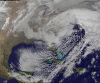
1996
http://mp1.met.psu.edu/~fxg1/NARR/1996/010800.png
http://mp1.met.psu.edu/~fxg1/NARR/1996/010800.png
NjWeatherGuy- Advanced Forecaster

- Posts : 4100
Reputation : 28
Join date : 2013-01-06
Location : Belle Mead, NJ
 Re: Long Range Thread 9.0
If this storm verifies I will be..... dont have the words in a winter like this...

NjWeatherGuy- Advanced Forecaster

- Posts : 4100
Reputation : 28
Join date : 2013-01-06
Location : Belle Mead, NJ
 Re: Long Range Thread 9.0
I'm getting excited as well but can anyone explain how the pattern has changed so quickly from two days ago and everyone was ready to give up. And headi,g storms behind this one what gives

skinsfan1177- Senior Enthusiast

- Posts : 4485
Reputation : 35
Join date : 2013-01-07
Age : 47
Location : Point Pleasant Boro
 Re: Long Range Thread 9.0
I can't ever recall seeing an ensemble mean 500 mb map like this. Truly amazing.amugs wrote:THIS IS SICKKKKKK FOR EPS ARE U FN KIDDING ME !!


nutleyblizzard- Senior Enthusiast

- Posts : 1964
Reputation : 41
Join date : 2014-01-30
Age : 58
Location : Nutley, new jersey
 Re: Long Range Thread 9.0
Any reason to think temps will be an issue? Or this will generate it's own cold air?
lglickman1- Pro Enthusiast

- Posts : 319
Reputation : 0
Join date : 2013-02-05
Location : New Rochelle, NY
 Re: Long Range Thread 9.0
skinsfan1177 wrote:I'm getting excited as well but can anyone explain how the pattern has changed so quickly from two days ago and everyone was ready to give up. And headi,g storms behind this one what gives
The models are always changing, which is why, as hard as it is not to want to give in, I have to restrain myself partially because of how much things have been constantly changing this year... As others have said hopefully this could be one to break the mold but we'll see.

NjWeatherGuy- Advanced Forecaster

- Posts : 4100
Reputation : 28
Join date : 2013-01-06
Location : Belle Mead, NJ
 Re: Long Range Thread 9.0
When should we make a thread for this threat?

snow247- Pro Enthusiast

- Posts : 2417
Reputation : 0
Join date : 2014-08-27
Location : Mount Ivy, NY - Elevation 545'
 Re: Long Range Thread 9.0
NJ I hear you I will wait to get real excited but that would be so nice if that happened.
jimv45- Senior Enthusiast

- Posts : 1168
Reputation : 36
Join date : 2013-09-20
Location : Hopewell jct.
 Re: Long Range Thread 9.0
skinsfan1177 wrote:I'm getting excited as well but can anyone explain how the pattern has changed so quickly from two days ago and everyone was ready to give up. And headi,g storms behind this one what gives
The AO is near -5sd
The long range going forward looks very good for February. End of January into Feb has always been the time frame for winter to arrive. We have an exciting 4-6 weeks ahead of us.
_________________
_______________________________________________________________________________________________________
CLICK HERE to view NJ Strong Snowstorm Classifications
 Re: Long Range Thread 9.0
Frank_Wx wrote:skinsfan1177 wrote:I'm getting excited as well but can anyone explain how the pattern has changed so quickly from two days ago and everyone was ready to give up. And headi,g storms behind this one what gives
The AO is near -5sd
The long range going forward looks very good for February. End of January into Feb has always been the time frame for winter to arrive. We have an exciting 4-6 weeks ahead of us.
Thanks Frank I got that but I thought things were looking really bleek two days ago. Loading the NAO along with other tele's. Then I thought their was a warm up. I guess it can change in a dime as yes your right in that you called it going into February great job.

skinsfan1177- Senior Enthusiast

- Posts : 4485
Reputation : 35
Join date : 2013-01-07
Age : 47
Location : Point Pleasant Boro
 Re: Long Range Thread 9.0
thanks Frank that is excellent news we deserve this after having the warmest December ever looking forward to have second half of a snowy winter thanks Frank and keep up the good work
frank 638- Senior Enthusiast

- Posts : 2882
Reputation : 37
Join date : 2016-01-01
Age : 41
Location : bronx ny
 Re: Long Range Thread 9.0
Patterns are naturally going to go through relaxation periods. I still think we may get one before we start up again. We'll see.
_________________
_______________________________________________________________________________________________________
CLICK HERE to view NJ Strong Snowstorm Classifications
 Re: Long Range Thread 9.0
Frank_Wx wrote:Patterns are naturally going to go through relaxation periods. I still think we may get one before we start up again. We'll see.
Frank three things:
One the latest on the PV is impressive that I posted from teh GEFS and GFS - my god it is beautiful
Two: thread should start tomorrow atger 12Z runs? or Tuesday 6Z - means we would be within 96 hours of this event
Lastly, remember when even I was not liking the LRF and said they will change - the relaxation looks to be a couple days Jan 31 - 2-2 ? That is so far off that iot will change as well as progged now.
_________________
Mugs
AKA:King: Snow Weenie
Self Proclaimed
WINTER 2014-15 : 55.12" +.02 for 6 coatings (avg. 35")
WINTER 2015-16 Total - 29.8" (Avg 35")
WINTER 2016-17 : 39.5" so far

amugs- Advanced Forecaster - Mod

- Posts : 15157
Reputation : 213
Join date : 2013-01-07
Age : 54
Location : Hillsdale,NJ
 Re: Long Range Thread 9.0
Frank, with the Euro and Canadian showing such an extreme scenario, is that the best scenario possible or can this trend even better for us i.e. stronger/colder system?

nutleyblizzard- Senior Enthusiast

- Posts : 1964
Reputation : 41
Join date : 2014-01-30
Age : 58
Location : Nutley, new jersey
 Re: Long Range Thread 9.0
From the Doc - ..............Judah Cohen Doc that is - sorry scott and docstox
tweeted this afternoon

winter uncancelled by him I guess?
tweeted this afternoon

winter uncancelled by him I guess?
_________________
Mugs
AKA:King: Snow Weenie
Self Proclaimed
WINTER 2014-15 : 55.12" +.02 for 6 coatings (avg. 35")
WINTER 2015-16 Total - 29.8" (Avg 35")
WINTER 2016-17 : 39.5" so far

amugs- Advanced Forecaster - Mod

- Posts : 15157
Reputation : 213
Join date : 2013-01-07
Age : 54
Location : Hillsdale,NJ
 Re: Long Range Thread 9.0
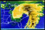
Wow, after seeing the Euro join the other models last night with a storm signal, and then seeing today's amazing run, its hard to not get excited... especially after such a dismal start to our winter season. Great turn of events! Mother nature always finds a way to even the score, and i've been glued to the forum just waiting for a KU signal to appear- i hope the trend continues and she truly delivers next weekend!
Radz- Pro Enthusiast

- Posts : 1028
Reputation : 17
Join date : 2013-01-12
Location : Cortlandt Manor NY
 Re: Long Range Thread 9.0
18z NAM is much further south and weaker than the 12z GFS at the same time. We'll see what the GFS does.

NjWeatherGuy- Advanced Forecaster

- Posts : 4100
Reputation : 28
Join date : 2013-01-06
Location : Belle Mead, NJ
 Re: Long Range Thread 9.0
State of the stratosphere by Iso therm:
Going forward, I think the pattern evolution is generally in alignment with prior posts, though, time will tell regarding the extent to which the reversal amplifies.
[1] The NAM transition into a predominately negative state has occurred over the past couple weeks, via tropospheric forcing mechanisms [i.e., Kara Sea ridge development, potentially instigated by a couple of background factors], stratospheric polar vortex elongation in response to initial strong wave-1 attack which has warmed the lower/mid stratosphere over the Pacific side of the Pole.
[2] Thus far, the severe -AO has not yielded any snowfall or extreme cold. The upcoming week will feature colder than normal temperatures. The rapid upward trend in both the AO and NAO modalities for the 18th-22nd period is a noted Archambault indicator for enhanced storminess / cyclogenesis along the East Coast. So the detection of a possible storm later in the week would coincide with statistics on prior sharp AO/NAO rises, and severe -AO dailies. However, if the western ridge amplitude is not sufficiently meridional and/or oriented more NE-SW rather than N-S, it will tend to force cyclogenesis too far S/E and push the storm offshore. This remains a possibility due to the off the charts +AAM state which has infused the Pacific Jet with incredible westerly momentum. The AAM tendency has been negative recently, but it is still very high. If the ridge remains amplified, there is enough downstream Atlantic residual blocking to prevent a warm/rainy scenario. Confluence appears strong. Largest risk is a S/E miss, in my view.
[3] The targeted period for robust wave activity [Jan 20-30] will be occurring with the strongest wave-1 pulse to date. Forecasted wave-1 heights, historically speaking, would be sufficient to induce a vortex displacement. Typically, the initial wave-1 hit is separated by a couple weeks of depressed flux prior to the second, stronger pulse. A potent +MT event in East Asia could develop as wave-1 increases concurrently, and this would enhance pressure on the vortex. The one wildcard remains the anomalously strong condition of the vortex this winter, which may require stronger wave activity than is typically needed to force SSWs. With that being said, I think the probability is mod-high for at least a minor SSW, whereby zonal winds slow significantly and 10hpa temperatures rise sharply. I am not certain that we will achieve a major SSW displacement, but the time frame continues to be near the end of January for that potential.
[4] Regardless of stratospheric progression, other tropospheric indicators are suggestive of the overall maintenance of high latitude blocking in February. I expect that the Western ridge reload will be extremely transient. A classic Nino NPAC looks probable for the end of the month with the Aleutian low and +PNA. GWO orbit and heightened AAM state support the aforementioned regime of S/E US troughiness and Rockies ridging as the month closes. The expectation for February continues to be the gradual retrogression of the GOA with a -AO and -NAO in the means. Depending upon the evolution of the stratosphere, this AO/NAO blocking could be either moderately robust or severe / similar in magnitude to the January episode. An official displacement would heighten the probability of protracted blocking.
Overall, it does not appear to me that we are paralleling the Nino winters which were torchy / snowless from front to back. The second half transition still looks on track. January is falling in accordance with the analogs; generally a near normal temperature departures with improved high latitude indicators.
_________________
Mugs
AKA:King: Snow Weenie
Self Proclaimed
WINTER 2014-15 : 55.12" +.02 for 6 coatings (avg. 35")
WINTER 2015-16 Total - 29.8" (Avg 35")
WINTER 2016-17 : 39.5" so far

amugs- Advanced Forecaster - Mod

- Posts : 15157
Reputation : 213
Join date : 2013-01-07
Age : 54
Location : Hillsdale,NJ
 Re: Long Range Thread 9.0
Dont jinx it!! No Thread until the storm is at least a day away or confirmed!!!
deadrabbit79- Posts : 176
Reputation : 6
Join date : 2013-01-25
Location : Hartsdale, New York
Page 28 of 40 •  1 ... 15 ... 27, 28, 29 ... 34 ... 40
Page 28 of 40
Permissions in this forum:
You cannot reply to topics in this forum
 Home
Home