01/12 Arctic Front Observations
+27
Biggin23
chief7
oldtimer
Taffy
jake732
GreyBeard
Dtone
1190ftalt
RJB8525
aiannone
hyde345
CPcantmeasuresnow
algae888
Grselig
weatherwatchermom
skinsfan1177
Mathgod55
Quietace
sroc4
justin92
LB3147
jmanley32
frank 638
snow247
NjWeatherGuy
amugs
Frank_Wx
31 posters
Page 1 of 9 • 1, 2, 3, 4, 5, 6, 7, 8, 9 
 01/12 Arctic Front Observations
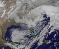
A strong piece of northern short wave upper energy will undercut the Polar Vortex and dig into the eastern CONUS. How far south the upper energy digs will depend on how much - if any - snow we could see. Right now I'm thinking a minor 1 to 3 inch event is possible.

The GFS handles these northern stream events better than the EURO. Above is the H5 vort mAP from the 18z GFS and you can see the trough is fairly potent and has some negative tilt. If this tries to go negative sooner, the coastal storm will develop faster and closer to the coast with plenty of cold air to work with.


Some of the GFS individual ensemble members really blow the storm up and bring a moderate event to the area. We'll see how this trends over the weekend. Timing looks to be late Tuesday into early Wednesday.

The GFS handles these northern stream events better than the EURO. Above is the H5 vort mAP from the 18z GFS and you can see the trough is fairly potent and has some negative tilt. If this tries to go negative sooner, the coastal storm will develop faster and closer to the coast with plenty of cold air to work with.


Some of the GFS individual ensemble members really blow the storm up and bring a moderate event to the area. We'll see how this trends over the weekend. Timing looks to be late Tuesday into early Wednesday.
Last edited by Frank_Wx on Mon Jan 11, 2016 6:50 pm; edited 1 time in total
_________________
_______________________________________________________________________________________________________
CLICK HERE to view NJ Strong Snowstorm Classifications
 Re: 01/12 Arctic Front Observations
Umm love this idea right now for an appetizer here like i said earlier in the LR thread 1-3 maybe we can squeeze a 2-4 out of this.
Para has slop storm but the storm is there for the next one
Para has slop storm but the storm is there for the next one
_________________
Mugs
AKA:King: Snow Weenie
Self Proclaimed
WINTER 2014-15 : 55.12" +.02 for 6 coatings (avg. 35")
WINTER 2015-16 Total - 29.8" (Avg 35")
WINTER 2016-17 : 39.5" so far

amugs- Advanced Forecaster - Mod

- Posts : 15157
Reputation : 213
Join date : 2013-01-07
Age : 54
Location : Hillsdale,NJ
 Re: 01/12 Arctic Front Observations

_________________
Mugs
AKA:King: Snow Weenie
Self Proclaimed
WINTER 2014-15 : 55.12" +.02 for 6 coatings (avg. 35")
WINTER 2015-16 Total - 29.8" (Avg 35")
WINTER 2016-17 : 39.5" so far

amugs- Advanced Forecaster - Mod

- Posts : 15157
Reputation : 213
Join date : 2013-01-07
Age : 54
Location : Hillsdale,NJ
 Re: 01/12 Arctic Front Observations
Id say a classic quick 1-3" clipper from what I see on the GFS and CMC, more north.

NjWeatherGuy- Advanced Forecaster

- Posts : 4100
Reputation : 28
Join date : 2013-01-06
Location : Belle Mead, NJ
 Re: 01/12 Arctic Front Observations
I would LOVE to get a simple 4 inches of snow from this.

snow247- Pro Enthusiast

- Posts : 2417
Reputation : 0
Join date : 2014-08-27
Location : Mount Ivy, NY - Elevation 545'
 Re: 01/12 Arctic Front Observations
I would be happy with 2 or 3 inches of snow I really want snow so bad
frank 638- Senior Enthusiast

- Posts : 2882
Reputation : 37
Join date : 2016-01-01
Age : 41
Location : bronx ny
 Re: 01/12 Arctic Front Observations
Me too, lets hope this trends stronger, but hey i will take any snow at this point. Get my totals list going lol. Here in central CT saw some small piles snow, they must had some recently.

jmanley32- Senior Enthusiast

- Posts : 20647
Reputation : 108
Join date : 2013-12-12
Age : 43
Location : Yonkers, NY
 Re: 01/12 Arctic Front Observations
Still some small piles of sleet/snow here from that storm that happened almost two weeks ago.

snow247- Pro Enthusiast

- Posts : 2417
Reputation : 0
Join date : 2014-08-27
Location : Mount Ivy, NY - Elevation 545'
 Re: 01/12 Arctic Front Observations
as little as I know....I surfed last week....the water is about 52 degrees....any interaction with this little clipper could amplify things....just a thought
LB3147- Posts : 31
Reputation : 0
Join date : 2014-11-11
 Re: 01/12 Arctic Front Observations
If the clipper gets stronger the less likely we will have a storm after right?
justin92- Posts : 16
Reputation : 0
Join date : 2016-01-01
 Re: 01/12 Arctic Front Observations
LB3147 wrote:as little as I know....I surfed last week....the water is about 52 degrees....any interaction with this little clipper could amplify things....just a thought
Good point. Coastal enhancement has been hinted at on the models.
justin92 wrote:If the clipper gets stronger the less likely we will have a storm after right?
Actually, a strong clipper would be good. It would eventually turn into our 50/50 Low.
_________________
_______________________________________________________________________________________________________
CLICK HERE to view NJ Strong Snowstorm Classifications
 Re: 01/12 Arctic Front Observations
Early on but the 00z GFS looking good with this so far.
The digging trend continues, I'm liking this run.
The digging trend continues, I'm liking this run.

snow247- Pro Enthusiast

- Posts : 2417
Reputation : 0
Join date : 2014-08-27
Location : Mount Ivy, NY - Elevation 545'
 Re: 01/12 Arctic Front Observations
Closes off at hour 93
And precip shield looking better. Should be a good run.
And precip shield looking better. Should be a good run.

snow247- Pro Enthusiast

- Posts : 2417
Reputation : 0
Join date : 2014-08-27
Location : Mount Ivy, NY - Elevation 545'
 Re: 01/12 Arctic Front Observations
Hour 96 light snow moving in, hoping for some enhancement the next few frames.

snow247- Pro Enthusiast

- Posts : 2417
Reputation : 0
Join date : 2014-08-27
Location : Mount Ivy, NY - Elevation 545'
 Re: 01/12 Arctic Front Observations
Just looks like light snow showers this run, BUT maybe the ratios could be good.
Looks like C-2".
Looks like C-2".

snow247- Pro Enthusiast

- Posts : 2417
Reputation : 0
Join date : 2014-08-27
Location : Mount Ivy, NY - Elevation 545'

snow247- Pro Enthusiast

- Posts : 2417
Reputation : 0
Join date : 2014-08-27
Location : Mount Ivy, NY - Elevation 545'
 Re: 01/12 Arctic Front Observations
What about the next storm?
justin92- Posts : 16
Reputation : 0
Join date : 2016-01-01
 Re: 01/12 Arctic Front Observations
justin92 wrote:What about the next storm?
Check long range thread
_________________
_______________________________________________________________________________________________________
CLICK HERE to view NJ Strong Snowstorm Classifications
 Re: 01/12 Arctic Front Observations
0z Euro not interested in this event.

snow247- Pro Enthusiast

- Posts : 2417
Reputation : 0
Join date : 2014-08-27
Location : Mount Ivy, NY - Elevation 545'
 Re: 01/12 Arctic Front Observations
This is drying out as runs continue, feeling like it will turn to a C-1" iso 2 north if youre lucky.

NjWeatherGuy- Advanced Forecaster

- Posts : 4100
Reputation : 28
Join date : 2013-01-06
Location : Belle Mead, NJ
 Re: 01/12 Arctic Front Observations
NjWeatherGuy wrote:This is drying out as runs continue, feeling like it will turn to a C-1" iso 2 north if youre lucky.
Certainly cant disagree with that. My hope is that the moisture depiction is underplayed and the warm atlantic will enhance things..a little. That prob wont be well modeled until the hi res short range models take a look or even nowcast if that theory holds at all. Most likely it would only benefit areas north and/or east of NYC
_________________
"In weather and in life, there's no winning and losing; there's only winning and learning."
WINTER 2012/2013 TOTALS 43.65"WINTER 2017/2018 TOTALS 62.85" WINTER 2022/2023 TOTALS 4.9"
WINTER 2013/2014 TOTALS 64.85"WINTER 2018/2019 TOTALS 14.25" WINTER 2023/2024 TOTALS 13.1"
WINTER 2014/2015 TOTALS 71.20"WINTER 2019/2020 TOTALS 6.35" WINTER 2024/2025 TOTALS 0.00
WINTER 2015/2016 TOTALS 35.00"WINTER 2020/2021 TOTALS 37.75"
WINTER 2016/2017 TOTALS 42.25"WINTER 2021/2022 TOTALS 31.65"

sroc4- Admin

- Posts : 8458
Reputation : 302
Join date : 2013-01-07
Location : Wading River, LI
 Re: 01/12 Arctic Front Observations
The Atlantic temps will not effect us much since the flow is heavily out the the W/NW. It should not have any effect on the precip shield, or moisture content of the air mass.sroc4 wrote:NjWeatherGuy wrote:This is drying out as runs continue, feeling like it will turn to a C-1" iso 2 north if youre lucky.
Certainly cant disagree with that. My hope is that the moisture depiction is underplayed and the warm atlantic will enhance things..a little. That prob wont be well modeled until the hi res short range models take a look or even nowcast if that theory holds at all. Most likely it would only benefit areas north and/or east of NYC
Last edited by Quietace on Sat Jan 09, 2016 10:13 am; edited 1 time in total

Quietace- Meteorologist - Mod

- Posts : 3689
Reputation : 33
Join date : 2013-01-07
Age : 27
Location : Point Pleasant, NJ
 Re: 01/12 Arctic Front Observations
This sucks......in a winter that so far has sucked too.
Guest- Guest
 Re: 01/12 Arctic Front Observations
Remember, good waiters get good tips!

Mathgod55- Posts : 60
Reputation : 0
Join date : 2013-01-08
Location : West Islip, NyY
 Re: 01/12 Arctic Front Observations
This system is losing some steam but there's still 3 full days of changes that could reinitiate the enhancement along the coast. There's a lot of upper level vorticity along the Arctic front.
_________________
_______________________________________________________________________________________________________
CLICK HERE to view NJ Strong Snowstorm Classifications
Page 1 of 9 • 1, 2, 3, 4, 5, 6, 7, 8, 9 
Permissions in this forum:
You cannot reply to topics in this forum
 Home
Home


