January 23, 2016 - Roidzilla Storm In Review
+14
sroc4
WeatherBob
amugs
richb521
elkiehound
petep1000
docstox12
Grselig
Mac003
nutleyblizzard
frank 638
jimv45
hyde345
Frank_Wx
18 posters
Page 2 of 2
Page 2 of 2 •  1, 2
1, 2
 Re: January 23, 2016 - Roidzilla Storm In Review
This was hands down my favorite moment of 2016.
Since November 2011, I have been tracking the models for potential storms, especially winter storms. I have seen numerous instances of Roidzillas on the models, especially 200+ hours out which don't happen. Some show up in the median range and don't happen. Another potential storm showed up 2-3 days out (1/26/15; "Juno") and did not pan out.
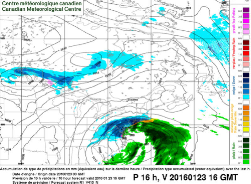
In this case, in the days leading up to it, it seemed like the storm would be suppressed (ala 2/6/10) and keep the big snows to our south. Throughout the day on Friday, January 22nd, models made a last minute trend northward with the snow, giving me excitement. Then that night, around the time the snow began, The 0Z RGEM came out and showed me this:

My post at 10:35 PM on the Observations thread (which I meant to put in the discussion thread):
WOW WOW WOW WOW WOW THE RGEM SHOWS A ROIDZILLA FOR NYC FROM THIS STORM!!!!!!
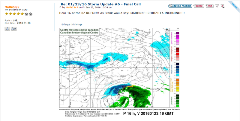
And at 10:39 PM in the Discussions thread, I posted the above image and said this:
"Hour 16 of the 0Z RGEM!!!! As Frank would say: MADONNE! ROIDZILLA INCOMING!!!!"
In my mind, I was screaming with excitement, I went to my father and said to him without hesitation, "WE'RE GETTING TWO FEET OF SNOW!!!" In this instance, a Roidzilla wasn't just possible, it wasn't just likely, it was IMMINENT!
I ended up with 25" of snow. While Bellerose does not keep official snowfall records, looking at Kocin-Uccilini snowmaps, the most snow that was recorded there prior to this occurred in the February 1969 Lindsay Day snowstorm, when 22" fell. This surpassed it alright!
This was a great moment in an otherwise dull winter, which was the second warmest on record.
Since November 2011, I have been tracking the models for potential storms, especially winter storms. I have seen numerous instances of Roidzillas on the models, especially 200+ hours out which don't happen. Some show up in the median range and don't happen. Another potential storm showed up 2-3 days out (1/26/15; "Juno") and did not pan out.
In this case, in the days leading up to it, it seemed like the storm would be suppressed (ala 2/6/10) and keep the big snows to our south. Throughout the day on Friday, January 22nd, models made a last minute trend northward with the snow, giving me excitement. Then that night, around the time the snow began, The 0Z RGEM came out and showed me this:

My post at 10:35 PM on the Observations thread (which I meant to put in the discussion thread):
WOW WOW WOW WOW WOW THE RGEM SHOWS A ROIDZILLA FOR NYC FROM THIS STORM!!!!!!
And at 10:39 PM in the Discussions thread, I posted the above image and said this:
"Hour 16 of the 0Z RGEM!!!! As Frank would say: MADONNE! ROIDZILLA INCOMING!!!!"
In my mind, I was screaming with excitement, I went to my father and said to him without hesitation, "WE'RE GETTING TWO FEET OF SNOW!!!" In this instance, a Roidzilla wasn't just possible, it wasn't just likely, it was IMMINENT!
I ended up with 25" of snow. While Bellerose does not keep official snowfall records, looking at Kocin-Uccilini snowmaps, the most snow that was recorded there prior to this occurred in the February 1969 Lindsay Day snowstorm, when 22" fell. This surpassed it alright!
This was a great moment in an otherwise dull winter, which was the second warmest on record.
Math23x7- Wx Statistician Guru

- Posts : 2382
Join date : 2013-01-08
 Re: January 23, 2016 - Roidzilla Storm In Review
Hands down my favorite snow event. 25" of snow IMBY! It began two years ago tonight!
Math23x7- Wx Statistician Guru

- Posts : 2382
Join date : 2013-01-08
 Re: January 23, 2016 - Roidzilla Storm In Review
When the 0Z RGEM came out, boy did I get excited. I told family and friends, without hesitation, "We're getting two feet of snow!!!"
I know I posted them the previous page but here are my two posts on this forum relating to that moment:


Man I loved this event. CPK, after further review, got 27.5" of snow from it, surpassing the 26.9" from the February 2006 event.
I know I posted them the previous page but here are my two posts on this forum relating to that moment:


Man I loved this event. CPK, after further review, got 27.5" of snow from it, surpassing the 26.9" from the February 2006 event.
Math23x7- Wx Statistician Guru

- Posts : 2382
Reputation : 68
Join date : 2013-01-08
 Re: January 23, 2016 - Roidzilla Storm In Review
This was the storm NAM lost its "Not A Model" title
_________________
_______________________________________________________________________________________________________
CLICK HERE to view NJ Strong Snowstorm Classifications
 Re: January 23, 2016 - Roidzilla Storm In Review
One of my all-time best storms. I was in the bullseye and experienced actual white-out conditions for a prolonged period of time. It just kept dumping snow for hours. And it was two weeks before I closed on my first house so took my mind off those nerves and I was glad it did not happen on the day I had to move.

billg315- Advanced Forecaster - Mod

- Posts : 4553
Reputation : 185
Join date : 2015-01-24
Age : 50
Location : Flemington, NJ
Page 2 of 2 •  1, 2
1, 2
Page 2 of 2
Permissions in this forum:
You cannot reply to topics in this forum
 Home
Home