
 Search
First Wintry Event - 11/15 to 11/16
Page 13 of 17 •  1 ... 8 ... 12, 13, 14, 15, 16, 17
 ![]()
Re: First Wintry Event - 11/15 to 11/16
![]() by WeatherBob Thu Nov 15, 2018 4:52 pm
by WeatherBob Thu Nov 15, 2018 4:52 pm
WeatherBob- Meteorologist

- Posts : 683
Join date : 2013-12-13
Re: First Wintry Event - 11/15 to 11/16
![]() by jmanley32 Thu Nov 15, 2018 4:53 pm
by jmanley32 Thu Nov 15, 2018 4:53 pm
jmanley32- Senior Enthusiast

- Posts : 20593
Join date : 2013-12-12
Re: First Wintry Event - 11/15 to 11/16
![]() by heehaw453 Thu Nov 15, 2018 5:00 pm
by heehaw453 Thu Nov 15, 2018 5:00 pm
heehaw453- Advanced Forecaster

- Posts : 3906
Reputation : 86
Join date : 2014-01-20
Location : Bedminster Township, PA Elevation 600' ASL
Re: First Wintry Event - 11/15 to 11/16
![]() by Vinnydula Thu Nov 15, 2018 5:05 pm
by Vinnydula Thu Nov 15, 2018 5:05 pm

Vinnydula- Pro Enthusiast

- Posts : 778
Reputation : 8
Join date : 2013-12-12
Location : Dobbs ferry
Re: First Wintry Event - 11/15 to 11/16
![]() by sroc4 Thu Nov 15, 2018 5:05 pm
by sroc4 Thu Nov 15, 2018 5:05 pm
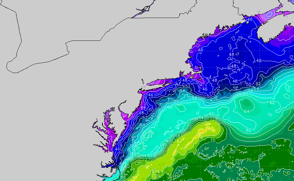
sroc4 wrote:I know my opinion has not been the most popular one so Ive kept it to myself as of late, but I still think this has very high bust potential for even areas N&W.
The center of the HP is very rapidly moving off the NE coast as the precip moves in. winds from the surface through 700mb have already shifted to the E through the S depending on the level you look at and the SST and air mass from which the winds from that direction is coming from is still very warm. The air source region is riding over watrer temps in the mid 50's through the upper 60's. There is no doubt the cold air is dense and will be diff to scour out but if this were even 1-2months later in the season and the water temps were in the 40's this would be a diff story. I really think the warm air will be more influential than otherwise might if later in the season. Also like Al alluded to earlier there is a 700 mb warm nose showing up in the modeling. The true depth of that warm nose could be important for many locals. I actually like Rbs original map right now with a few changes based on new information. Il do my best to post a map and a write up if I can.
Timing will be everything. Dew points start very low over much of the area but in a very short time, less than 3 hrs, the entire coastal plain dew points get above freezing all the while surface temps are 32-36 from NW to SE. IF a heavy band can come in during this window than a thump is possible, but there are dif in where and when the "thump arrives. This will be absolutely key to who gets the thump of accumulation and who doesnt. Without a strong dbz band of precip within the window even areas N&W will have diff accumulating.
As you can see by the content above my account had been hacked. Rest assured the problem is fixed.
_________________
"In weather and in life, there's no winning and losing; there's only winning and learning."
WINTER 2012/2013 TOTALS 43.65"WINTER 2017/2018 TOTALS 62.85" WINTER 2022/2023 TOTALS 4.9"
WINTER 2013/2014 TOTALS 64.85"WINTER 2018/2019 TOTALS 14.25" WINTER 2023/2024 TOTALS 13.1"
WINTER 2014/2015 TOTALS 71.20"WINTER 2019/2020 TOTALS 6.35"
WINTER 2015/2016 TOTALS 35.00"WINTER 2020/2021 TOTALS 37.75"
WINTER 2016/2017 TOTALS 42.25"WINTER 2021/2022 TOTALS 31.65"

sroc4- Admin

- Posts : 8390
Reputation : 302
Join date : 2013-01-07
Location : Wading River, LI
Re: First Wintry Event - 11/15 to 11/16
![]() by CPcantmeasuresnow Thu Nov 15, 2018 5:16 pm
by CPcantmeasuresnow Thu Nov 15, 2018 5:16 pm
sroc4 wrote:sroc4 wrote:I know my opinion has not been the most popular one so Ive kept it to myself as of late, but I still think this has very high bust potential for even areas N&W.
The center of the HP is very rapidly moving off the NE coast as the precip moves in. winds from the surface through 700mb have already shifted to the E through the S depending on the level you look at and the SST and air mass from which the winds from that direction is coming from is still very warm. The air source region is riding over watrer temps in the mid 50's through the upper 60's. There is no doubt the cold air is dense and will be diff to scour out but if this were even 1-2months later in the season and the water temps were in the 40's this would be a diff story. I really think the warm air will be more influential than otherwise might if later in the season. Also like Al alluded to earlier there is a 700 mb warm nose showing up in the modeling. The true depth of that warm nose could be important for many locals. I actually like Rbs original map right now with a few changes based on new information. Il do my best to post a map and a write up if I can.
Timing will be everything. Dew points start very low over much of the area but in a very short time, less than 3 hrs, the entire coastal plain dew points get above freezing all the while surface temps are 32-36 from NW to SE. IF a heavy band can come in during this window than a thump is possible, but there are dif in where and when the "thump arrives. This will be absolutely key to who gets the thump of accumulation and who doesnt. Without a strong dbz band of precip within the window even areas N&W will have diff accumulating.
As you can see by the content above my account had been hacked. Rest assured the problem is fixed.
Hate when that happens.

CPcantmeasuresnow- Wx Statistician Guru

- Posts : 7274
Reputation : 230
Join date : 2013-01-07
Age : 103
Location : Eastern Orange County, NY
Re: First Wintry Event - 11/15 to 11/16
![]() by WeatherBob Thu Nov 15, 2018 5:19 pm
by WeatherBob Thu Nov 15, 2018 5:19 pm

WeatherBob- Meteorologist
- Posts : 683
Reputation : 83
Join date : 2013-12-13
Location : Caldwell, NJ - NW Essex County - Altitude 500 FT
Re: First Wintry Event - 11/15 to 11/16
![]() by WeatherBob Thu Nov 15, 2018 5:20 pm
by WeatherBob Thu Nov 15, 2018 5:20 pm
WeatherBob- Meteorologist
- Posts : 683
Reputation : 83
Join date : 2013-12-13
Location : Caldwell, NJ - NW Essex County - Altitude 500 FT
Re: First Wintry Event - 11/15 to 11/16
![]() by Guest Thu Nov 15, 2018 5:25 pm
by Guest Thu Nov 15, 2018 5:25 pm

Guest- Guest
Vinnydula- Pro Enthusiast
- Posts : 778
Reputation : 8
Join date : 2013-12-12
Location : Dobbs ferry
Re: First Wintry Event - 11/15 to 11/16
![]() by skinsfan1177 Thu Nov 15, 2018 5:27 pm
by skinsfan1177 Thu Nov 15, 2018 5:27 pm

skinsfan1177- Senior Enthusiast
- Posts : 4485
Reputation : 35
Join date : 2013-01-07
Age : 46
Location : Point Pleasant Boro
Re: First Wintry Event - 11/15 to 11/16
![]() by billg315 Thu Nov 15, 2018 5:31 pm
by billg315 Thu Nov 15, 2018 5:31 pm

billg315- Advanced Forecaster - Mod

- Posts : 4511
Reputation : 185
Join date : 2015-01-24
Age : 50
Location : Flemington, NJ
Re: First Wintry Event - 11/15 to 11/16
![]() by RJB8525 Thu Nov 15, 2018 5:46 pm
by RJB8525 Thu Nov 15, 2018 5:46 pm

RJB8525- Senior Enthusiast
- Posts : 1994
Reputation : 28
Join date : 2013-02-06
Age : 38
Location : Hackettstown, NJ
Re: First Wintry Event - 11/15 to 11/16
![]() by 2004blackwrx Thu Nov 15, 2018 5:53 pm
by 2004blackwrx Thu Nov 15, 2018 5:53 pm
2004blackwrx- Pro Enthusiast
- Posts : 576
Reputation : 9
Join date : 2013-01-14
Location : Wappinger NY
Re: First Wintry Event - 11/15 to 11/16
![]() by Vinnydula Thu Nov 15, 2018 5:54 pm
by Vinnydula Thu Nov 15, 2018 5:54 pm
Vinnydula- Pro Enthusiast
- Posts : 778
Reputation : 8
Join date : 2013-12-12
Location : Dobbs ferry
Re: First Wintry Event - 11/15 to 11/16
![]() by bloc1357 Thu Nov 15, 2018 5:58 pm
by bloc1357 Thu Nov 15, 2018 5:58 pm
Rain snow line just at the south shore of LI
bloc1357- Pro Enthusiast
- Posts : 344
Reputation : 10
Join date : 2013-03-05
Age : 47
Location : West Babylon, NY - 11704
Re: First Wintry Event - 11/15 to 11/16
![]() by CPcantmeasuresnow Thu Nov 15, 2018 6:00 pm
by CPcantmeasuresnow Thu Nov 15, 2018 6:00 pm
2004blackwrx wrote:7 inches in 2 hours wow
fantastic.
The HV rules.
Watch out for RB though he'll report 3 inches from Fishkill.
CPcantmeasuresnow- Wx Statistician Guru
- Posts : 7274
Reputation : 230
Join date : 2013-01-07
Age : 103
Location : Eastern Orange County, NY
Re: First Wintry Event - 11/15 to 11/16
![]() by SoulSingMG Thu Nov 15, 2018 6:36 pm
by SoulSingMG Thu Nov 15, 2018 6:36 pm

SoulSingMG- Senior Enthusiast
- Posts : 2853
Reputation : 74
Join date : 2013-12-11
Location : Long Island City, NY
Re: First Wintry Event - 11/15 to 11/16
![]() by WeatherBob Thu Nov 15, 2018 6:40 pm
by WeatherBob Thu Nov 15, 2018 6:40 pm
WeatherBob- Meteorologist
- Posts : 683
Reputation : 83
Join date : 2013-12-13
Location : Caldwell, NJ - NW Essex County - Altitude 500 FT
Re: First Wintry Event - 11/15 to 11/16
![]() by docstox12 Thu Nov 15, 2018 6:51 pm
by docstox12 Thu Nov 15, 2018 6:51 pm

docstox12- Wx Statistician Guru
- Posts : 8557
Reputation : 222
Join date : 2013-01-07
Age : 73
Location : Monroe NY
Re: First Wintry Event - 11/15 to 11/16
![]() by freezerburn Thu Nov 15, 2018 6:51 pm
by freezerburn Thu Nov 15, 2018 6:51 pm
freezerburn- Posts : 16
Reputation : 1
Join date : 2014-01-01
Location : Toms River
Re: First Wintry Event - 11/15 to 11/16
![]() by WeatherBob Thu Nov 15, 2018 6:53 pm
by WeatherBob Thu Nov 15, 2018 6:53 pm
WeatherBob- Meteorologist
- Posts : 683
Reputation : 83
Join date : 2013-12-13
Location : Caldwell, NJ - NW Essex County - Altitude 500 FT
Vinnydula- Pro Enthusiast
- Posts : 778
Reputation : 8
Join date : 2013-12-12
Location : Dobbs ferry
WeatherBob- Meteorologist
- Posts : 683
Reputation : 83
Join date : 2013-12-13
Location : Caldwell, NJ - NW Essex County - Altitude 500 FT
Re: First Wintry Event - 11/15 to 11/16
![]() by jmanley32 Thu Nov 15, 2018 7:01 pm
by jmanley32 Thu Nov 15, 2018 7:01 pm

jmanley32- Senior Enthusiast
- Posts : 20593
Reputation : 108
Join date : 2013-12-12
Age : 43
Location : Yonkers, NY
Re: First Wintry Event - 11/15 to 11/16
![]() by sroc4 Thu Nov 15, 2018 7:01 pm
by sroc4 Thu Nov 15, 2018 7:01 pm
_________________
"In weather and in life, there's no winning and losing; there's only winning and learning."
WINTER 2012/2013 TOTALS 43.65"WINTER 2017/2018 TOTALS 62.85" WINTER 2022/2023 TOTALS 4.9"
WINTER 2013/2014 TOTALS 64.85"WINTER 2018/2019 TOTALS 14.25" WINTER 2023/2024 TOTALS 13.1"
WINTER 2014/2015 TOTALS 71.20"WINTER 2019/2020 TOTALS 6.35"
WINTER 2015/2016 TOTALS 35.00"WINTER 2020/2021 TOTALS 37.75"
WINTER 2016/2017 TOTALS 42.25"WINTER 2021/2022 TOTALS 31.65"
sroc4- Admin
- Posts : 8390
Reputation : 302
Join date : 2013-01-07
Location : Wading River, LI
Re: First Wintry Event - 11/15 to 11/16
![]() by jmanley32 Thu Nov 15, 2018 7:02 pm
by jmanley32 Thu Nov 15, 2018 7:02 pm
Frank little to no accumulation along coast huh? I say we have at least 6 not if more and WSW updated at 5 saying 3-5 more, this may be a high end motherazilla to godzilla for some.WeatherBob wrote:6 in in Central Park!
jmanley32- Senior Enthusiast
- Posts : 20593
Reputation : 108
Join date : 2013-12-12
Age : 43
Location : Yonkers, NY
Page 13 of 17 • 1 ... 8 ... 12, 13, 14, 15, 16, 17 ![]()
|
|
|