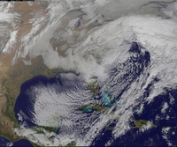
01/22/16-01/23/16 Update #1 - Historic Storm Possible
+45
nnjwxguy78
lglickman1
jwalsh
Teetghhuhnbhj
Sunflowers138
Dave1978
devsman
Cyanide02Z06
Grselig
track17
Dunnzoo
Dtone
CPcantmeasuresnow
weatherwatchermom
aiannone
jimv45
Biggin23
billg315
docstox12
Quietace
GreyBeard
RJB8525
Snowfall
frank 638
Joe Snow
SNOW MAN
jmanley32
chief7
rb924119
Artechmetals
Math23x7
algae888
Abba701
SoulSingMG
sroc4
mako460
skinsfan1177
nutleyblizzard
jake732
amugs
oldtimer
hyde345
snow247
NjWeatherGuy
Frank_Wx
49 posters
Page 1 of 26
Page 1 of 26 • 1, 2, 3 ... 13 ... 26 
 01/22/16-01/23/16 Update #1 - Historic Storm Possible
A series of updates will be released over the next few days. You can expect them between 8-9pm every night. Give the blog a read and if you have any questions please ask. Keep in mind I will not answer questions on timing and snow amounts. You will notice in the blog I do not even post snow maps from models. These type of specifics will not be known until Wednesday morning (if there is even still a storm to track by then).
http://njstrongweather.blogspot.com/2016/01/watching-january-22nd-23rd-potential.html
http://njstrongweather.blogspot.com/2016/01/watching-january-22nd-23rd-potential.html
_________________
_______________________________________________________________________________________________________
CLICK HERE to view NJ Strong Snowstorm Classifications
 Re: 01/22/16-01/23/16 Update #1 - Historic Storm Possible
For this situation and flow, we want the 500mb and surface low to close off right off the Jersey Coast (well inside the BM) and bomb out and stall, similar to what the CMC/EURO showed and what happened in '96.
http://www.raymondcmartinjr.com/weather/1996/07-Jan-96-500MillibarMaps.html
http://www.raymondcmartinjr.com/weather/1996/07-Jan-96-SeaLevelPressure.html
http://www.raymondcmartinjr.com/weather/1996/07-Jan-96-500MillibarMaps.html
http://www.raymondcmartinjr.com/weather/1996/07-Jan-96-SeaLevelPressure.html

NjWeatherGuy- Advanced Forecaster

- Posts : 4100
Reputation : 28
Join date : 2013-01-06
Location : Belle Mead, NJ
 Re: 01/22/16-01/23/16 Update #1 - Historic Storm Possible
NjWeatherGuy wrote:For this situation and flow, we want the 500mb and surface low to close off right off the Jersey Coast (well inside the BM) and bomb out and stall, similar to what the CMC/EURO showed and what happened in '96.
http://www.raymondcmartinjr.com/weather/1996/07-Jan-96-500MillibarMaps.html
http://www.raymondcmartinjr.com/weather/1996/07-Jan-96-SeaLevelPressure.html
That western ridge in 96' looked much better than what we're dealing with. This is a fluid setup.
_________________
_______________________________________________________________________________________________________
CLICK HERE to view NJ Strong Snowstorm Classifications
 Re: 01/22/16-01/23/16 Update #1 - Historic Storm Possible
Suppression is the biggest threat here from what I see on the ensembles, with that banana high no chance of cutting up the lakes or apps.

NjWeatherGuy- Advanced Forecaster

- Posts : 4100
Reputation : 28
Join date : 2013-01-06
Location : Belle Mead, NJ
 Re: 01/22/16-01/23/16 Update #1 - Historic Storm Possible
Doesn't look too bad here, too many energies in the Pac though that low coming into the NW may moderate the ridge.
http://meteocentre.com/models/explorateur.php?lang=en&map=na&run=12&mod=gemglb&stn=QQ500&comp=1&run2=12&mod2=gemglb&stn2=QQ500&hh2=120&fixhh=1&stn2_type=prog&mode=latest&yyyy=latest&mm=latest&dd=latest&hh=132
http://meteocentre.com/models/explorateur.php?lang=en&map=na&run=12&mod=gemglb&stn=QQ500&comp=1&run2=12&mod2=gemglb&stn2=QQ500&hh2=120&fixhh=1&stn2_type=prog&mode=latest&yyyy=latest&mm=latest&dd=latest&hh=132

NjWeatherGuy- Advanced Forecaster

- Posts : 4100
Reputation : 28
Join date : 2013-01-06
Location : Belle Mead, NJ
 Re: 01/22/16-01/23/16 Update #1 - Historic Storm Possible
Nice and exciting update Frank - Best one so far.

snow247- Pro Enthusiast

- Posts : 2417
Reputation : 0
Join date : 2014-08-27
Location : Mount Ivy, NY - Elevation 545'
 Re: 01/22/16-01/23/16 Update #1 - Historic Storm Possible
All the models have a storm and even the GFS shows a moderate to significant event even though it is the most south and east. The Euro, Euro para, cmc, and their ensembles show a beast. We are only 5 days away and I'm trusting the Euro on this one. It has proven time and time again to be the superior model, locking on to complex dynamics faster than the GFS and then the GFS plays catch up and comes around 48 hours before the event. I know all solutions are still on the table but I'm willing to bet this is going to be a HECS.

hyde345- Pro Enthusiast

- Posts : 1083
Reputation : 48
Join date : 2013-01-08
Location : Hyde Park, NY
 Re: 01/22/16-01/23/16 Update #1 - Historic Storm Possible
Thanks Frank. Really appericate your work. The explanation was so thorough and for me was easier to understand. Excited about the upcoming week
oldtimer- Senior Enthusiast

- Posts : 1103
Reputation : 14
Join date : 2013-01-16
Age : 78
Location : Port Jefferson Station Suffolk County
 Re: 01/22/16-01/23/16 Update #1 - Historic Storm Possible
00z gfs will initialize soon.
_________________
_______________________________________________________________________________________________________
CLICK HERE to view NJ Strong Snowstorm Classifications
 Re: 01/22/16-01/23/16 Update #1 - Historic Storm Possible
biggest difference so far is lead vort is weaker
_________________
_______________________________________________________________________________________________________
CLICK HERE to view NJ Strong Snowstorm Classifications
 Re: 01/22/16-01/23/16 Update #1 - Historic Storm Possible
Frank excellent analysis and thanks for taking the time to do this.
_________________
Mugs
AKA:King: Snow Weenie
Self Proclaimed
WINTER 2014-15 : 55.12" +.02 for 6 coatings (avg. 35")
WINTER 2015-16 Total - 29.8" (Avg 35")
WINTER 2016-17 : 39.5" so far

amugs- Advanced Forecaster - Mod

- Posts : 15148
Reputation : 213
Join date : 2013-01-07
Age : 54
Location : Hillsdale,NJ
 Re: 01/22/16-01/23/16 Update #1 - Historic Storm Possible
jake732 wrote:So is this bad news? Basically same?
It is fine it is looking very good like teh 12 z run so far.
_________________
Mugs
AKA:King: Snow Weenie
Self Proclaimed
WINTER 2014-15 : 55.12" +.02 for 6 coatings (avg. 35")
WINTER 2015-16 Total - 29.8" (Avg 35")
WINTER 2016-17 : 39.5" so far

amugs- Advanced Forecaster - Mod

- Posts : 15148
Reputation : 213
Join date : 2013-01-07
Age : 54
Location : Hillsdale,NJ
 Re: 01/22/16-01/23/16 Update #1 - Historic Storm Possible
Dug in deep in the South - 500mb looks great - need a full phase at the base - could be.......
_________________
Mugs
AKA:King: Snow Weenie
Self Proclaimed
WINTER 2014-15 : 55.12" +.02 for 6 coatings (avg. 35")
WINTER 2015-16 Total - 29.8" (Avg 35")
WINTER 2016-17 : 39.5" so far

amugs- Advanced Forecaster - Mod

- Posts : 15148
Reputation : 213
Join date : 2013-01-07
Age : 54
Location : Hillsdale,NJ
 Re: 01/22/16-01/23/16 Update #1 - Historic Storm Possible
at 111, 114 she looks great - another beast of a run on 0z here tonight HUGE SLUG of moisture from STJ
_________________
Mugs
AKA:King: Snow Weenie
Self Proclaimed
WINTER 2014-15 : 55.12" +.02 for 6 coatings (avg. 35")
WINTER 2015-16 Total - 29.8" (Avg 35")
WINTER 2016-17 : 39.5" so far

amugs- Advanced Forecaster - Mod

- Posts : 15148
Reputation : 213
Join date : 2013-01-07
Age : 54
Location : Hillsdale,NJ
 Re: 01/22/16-01/23/16 Update #1 - Historic Storm Possible
going to be another hit
_________________
_______________________________________________________________________________________________________
CLICK HERE to view NJ Strong Snowstorm Classifications
 Re: 01/22/16-01/23/16 Update #1 - Historic Storm Possible
GET READY BOYS AND GIRLS CAUSE WE ARE GOING TO HAVE A ...........

RIODZILLAAAAAA???????

RIODZILLAAAAAA???????
_________________
Mugs
AKA:King: Snow Weenie
Self Proclaimed
WINTER 2014-15 : 55.12" +.02 for 6 coatings (avg. 35")
WINTER 2015-16 Total - 29.8" (Avg 35")
WINTER 2016-17 : 39.5" so far

amugs- Advanced Forecaster - Mod

- Posts : 15148
Reputation : 213
Join date : 2013-01-07
Age : 54
Location : Hillsdale,NJ
 Re: 01/22/16-01/23/16 Update #1 - Historic Storm Possible
this is going to be massive
_________________
_______________________________________________________________________________________________________
CLICK HERE to view NJ Strong Snowstorm Classifications
 Re: 01/22/16-01/23/16 Update #1 - Historic Storm Possible
Is the low closed Frank? That would be key for a closer to the coast scenario.Frank_Wx wrote:going to be another hit

nutleyblizzard- Senior Enthusiast

- Posts : 1963
Reputation : 41
Join date : 2014-01-30
Age : 58
Location : Nutley, new jersey
 Re: 01/22/16-01/23/16 Update #1 - Historic Storm Possible
FRANK she looks marvelous 700, 500mb holy smokes

INCOMING TAKE COVERRRRRR

INCOMING TAKE COVERRRRRR
_________________
Mugs
AKA:King: Snow Weenie
Self Proclaimed
WINTER 2014-15 : 55.12" +.02 for 6 coatings (avg. 35")
WINTER 2015-16 Total - 29.8" (Avg 35")
WINTER 2016-17 : 39.5" so far

amugs- Advanced Forecaster - Mod

- Posts : 15148
Reputation : 213
Join date : 2013-01-07
Age : 54
Location : Hillsdale,NJ
 Re: 01/22/16-01/23/16 Update #1 - Historic Storm Possible
NUTS CLOSED OVER TN - WOOO HOOO


_________________
Mugs
AKA:King: Snow Weenie
Self Proclaimed
WINTER 2014-15 : 55.12" +.02 for 6 coatings (avg. 35")
WINTER 2015-16 Total - 29.8" (Avg 35")
WINTER 2016-17 : 39.5" so far

amugs- Advanced Forecaster - Mod

- Posts : 15148
Reputation : 213
Join date : 2013-01-07
Age : 54
Location : Hillsdale,NJ
 Re: 01/22/16-01/23/16 Update #1 - Historic Storm Possible

WHAT DO YUO THINK NOW?????
_________________
Mugs
AKA:King: Snow Weenie
Self Proclaimed
WINTER 2014-15 : 55.12" +.02 for 6 coatings (avg. 35")
WINTER 2015-16 Total - 29.8" (Avg 35")
WINTER 2016-17 : 39.5" so far

amugs- Advanced Forecaster - Mod

- Posts : 15148
Reputation : 213
Join date : 2013-01-07
Age : 54
Location : Hillsdale,NJ
 Re: 01/22/16-01/23/16 Update #1 - Historic Storm Possible
_________________
_______________________________________________________________________________________________________
CLICK HERE to view NJ Strong Snowstorm Classifications
 Re: 01/22/16-01/23/16 Update #1 - Historic Storm Possible
DA CRUSHERRRRRRRRRRRRRRRRR


_________________
Mugs
AKA:King: Snow Weenie
Self Proclaimed
WINTER 2014-15 : 55.12" +.02 for 6 coatings (avg. 35")
WINTER 2015-16 Total - 29.8" (Avg 35")
WINTER 2016-17 : 39.5" so far

amugs- Advanced Forecaster - Mod

- Posts : 15148
Reputation : 213
Join date : 2013-01-07
Age : 54
Location : Hillsdale,NJ
 Re: 01/22/16-01/23/16 Update #1 - Historic Storm Possible
i have no words


_________________
_______________________________________________________________________________________________________
CLICK HERE to view NJ Strong Snowstorm Classifications
Page 1 of 26 • 1, 2, 3 ... 13 ... 26 
Page 1 of 26
Permissions in this forum:
You cannot reply to topics in this forum
 Home
Home