February 1st-2nd Roidzilla, Part IV: Final Forecast
+75
sabamfa
AlphaOrionis42
essexcountypete
kcarnegie275
Artechmetals
richb521
Dunnzoo
crippo84
SNOW MAN
jbnyy224
dfig529
elkiehound
SkiSeadooJoe
phil155
nutleyblizzard
kalleg
Radz
docstox12
snowlover78
sroc4
Sparky Sparticles
Taffy
dkodgis
jaydoy
2004blackwrx
marin1804
hyde345
dsix85
stAtic9
gigs68
Zhukov1945
Scullybutcher
Mike1984
oldtimer
rb924119
1190ftalt
AMD95
aiannone
snowday111
Irish
Snownyc
Math23x7
mmanisca
adamfitz1969
algae888
Fededle22
mwilli
Gator99
brownie
Vinnydula
lglickman1
SENJsnowman
emokid51783
bloc1357
lznachu
CnWestMilford76
WeatherBob
jtswife
amugs
Angela0621
DAYBLAZER
heehaw453
weatherwatchermom
SoulSingMG
Joe Snow
GreyBeard
Grselig
colosa4
CPcantmeasuresnow
larryrock72
frank 638
billg315
jmanley32
CDF24
Frank_Wx
79 posters
Page 10 of 29
Page 10 of 29 •  1 ... 6 ... 9, 10, 11 ... 19 ... 29
 Re: February 1st-2nd Roidzilla, Part IV: Final Forecast
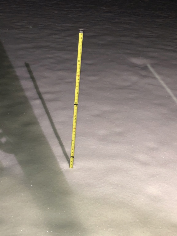
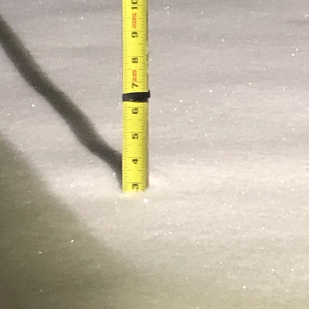
Moderate to heavy snow (bigger dendrites). About 4.5" otg.
20/19.3
20/19.3
heehaw453- Advanced Forecaster

- Posts : 3916
Join date : 2014-01-20
 Re: February 1st-2nd Roidzilla, Part IV: Final Forecast
23/29 First Flakes Whew!
oldtimer- Senior Enthusiast

- Posts : 1103
Join date : 2013-01-16
 Re: February 1st-2nd Roidzilla, Part IV: Final Forecast
Looks like some pretty solid bands setting up over philly now moving NE

Zhukov1945- Posts : 138
Reputation : 8
Join date : 2018-03-21
Location : Clinton Township NJ
 Re: February 1st-2nd Roidzilla, Part IV: Final Forecast
First Flakes falling in Commack. Northwest SuffolK LI

gigs68- Posts : 142
Reputation : 3
Join date : 2013-01-16
Location : Commack, NY (NW Suffolk)
 Re: February 1st-2nd Roidzilla, Part IV: Final Forecast
heehaw453 wrote:Moderate to heavy snow (bigger dendrites). About 4.5" otg.
20/19.3
This is a pretty good unscientific snow rate calculator because each of those bands coming through your area rolls through my area and every hour you’re a little over an inch ahead of my accumulation. Lol. So those bands must be just about 1” per hour rates.

billg315- Advanced Forecaster - Mod

- Posts : 4539
Reputation : 185
Join date : 2015-01-24
Age : 50
Location : Flemington, NJ
 Re: February 1st-2nd Roidzilla, Part IV: Final Forecast
Who called it hmm? NYC state of emergency, but not the rest of the area?
https://abc7ny.com/nyc-schools-closed-snow-how-much-mayor-bill-de-blasio/10187668/
https://abc7ny.com/nyc-schools-closed-snow-how-much-mayor-bill-de-blasio/10187668/

jmanley32- Senior Enthusiast

- Posts : 20639
Reputation : 108
Join date : 2013-12-12
Age : 43
Location : Yonkers, NY
 Re: February 1st-2nd Roidzilla, Part IV: Final Forecast
Yeah there is a heavy band from Philly back through Montgomery Co that is probably headed this way after the current moderate to heavy band passes.Zhukov1945 wrote:Looks like some pretty solid bands setting up over philly now moving NE

billg315- Advanced Forecaster - Mod

- Posts : 4539
Reputation : 185
Join date : 2015-01-24
Age : 50
Location : Flemington, NJ
 Re: February 1st-2nd Roidzilla, Part IV: Final Forecast
Ok, so I have some ponderances based on my observations of current radar trends and broad recollection of the general evolution of the modeling. The first image is a current radar image with the overlays of where I think current banding is indicating the eventual development of quasi-stationary, pivoting banding features (in red). The northern one should become established BEFORE the southern one, as it will be forced by the general large-scale deformation/frontogenesis. The southern one will be associated with the maturing low- and mid-level cyclones tomorrow.

The second image depicts how I think these same bands will orient themselves before becoming quasi-stationary as the the storm matured and then occludes, before they begin to then expand away as the system decays.

The area in red between the two bands denotes where there will likely be a period of subsidence as the first band begins to rotate a little further north before the secondary band becomes established to recover. That region would then shift a bit further west-northwest during the maturation and occlusion processes. So, these two areas are where I think we may see the best totals, BUT THIS IS SOLELY MY OPINION BASED ON WHAT IM SEEING IN THE RADAR TRENDS WITH SOME PREVIOUS THOUGHTS MIXED IN. I’m testing a hypothesis here that you can pick out areas of *preferred* banding tendencies based on certain radar/early precipitation trends. Will be fun to watch evolve at the very least.

The second image depicts how I think these same bands will orient themselves before becoming quasi-stationary as the the storm matured and then occludes, before they begin to then expand away as the system decays.

The area in red between the two bands denotes where there will likely be a period of subsidence as the first band begins to rotate a little further north before the secondary band becomes established to recover. That region would then shift a bit further west-northwest during the maturation and occlusion processes. So, these two areas are where I think we may see the best totals, BUT THIS IS SOLELY MY OPINION BASED ON WHAT IM SEEING IN THE RADAR TRENDS WITH SOME PREVIOUS THOUGHTS MIXED IN. I’m testing a hypothesis here that you can pick out areas of *preferred* banding tendencies based on certain radar/early precipitation trends. Will be fun to watch evolve at the very least.
rb924119- Meteorologist

- Posts : 7043
Reputation : 195
Join date : 2013-02-06
Age : 32
Location : Greentown, Pa
 Re: February 1st-2nd Roidzilla, Part IV: Final Forecast
Wow
http://sirocco.accuweather.com/nxssa_r1_h_500x620d/r1h/inxr1Kphla_h.gif
http://sirocco.accuweather.com/nxssa_r1_h_500x620d/r1h/inxr1Kphla_h.gif
_________________
_______________________________________________________________________________________________________
CLICK HERE to view NJ Strong Snowstorm Classifications
 Re: February 1st-2nd Roidzilla, Part IV: Final Forecast
Frank_Wx wrote:Wow
http://sirocco.accuweather.com/nxssa_r1_h_500x620d/r1h/inxr1Kphla_h.gif
Love that many of us have 3-4" before the real bands even get started. Great sign.

Zhukov1945- Posts : 138
Reputation : 8
Join date : 2018-03-21
Location : Clinton Township NJ
 Re: February 1st-2nd Roidzilla, Part IV: Final Forecast
Frank_Wx wrote:Wow
http://sirocco.accuweather.com/nxssa_r1_h_500x620d/r1h/inxr1Kphla_h.gif
That yellow band is brightbanding, indicating the mix line. Confirmed with Dual-pol.
rb924119- Meteorologist

- Posts : 7043
Reputation : 195
Join date : 2013-02-06
Age : 32
Location : Greentown, Pa
 Re: February 1st-2nd Roidzilla, Part IV: Final Forecast
rb924119 wrote:Frank_Wx wrote:Wow
http://sirocco.accuweather.com/nxssa_r1_h_500x620d/r1h/inxr1Kphla_h.gif
That yellow band is brightbanding, indicating the mix line. Confirmed with Dual-pol.
Is it too basic to think that the mix line going forward is likely Annapolis MD (which is right on the edge) due NE up to just east of NYC?

Zhukov1945- Posts : 138
Reputation : 8
Join date : 2018-03-21
Location : Clinton Township NJ
 Re: February 1st-2nd Roidzilla, Part IV: Final Forecast
rb924119 wrote:Frank_Wx wrote:Wow
http://sirocco.accuweather.com/nxssa_r1_h_500x620d/r1h/inxr1Kphla_h.gif
That yellow band is brightbanding, indicating the mix line. Confirmed with Dual-pol.
Yup
But check out that CNJ band. Who's under that?
_________________
_______________________________________________________________________________________________________
CLICK HERE to view NJ Strong Snowstorm Classifications

1190ftalt- Pro Enthusiast

- Posts : 404
Reputation : 10
Join date : 2013-12-13
Location : Stillwater, NJ
heehaw453 likes this post
 Re: February 1st-2nd Roidzilla, Part IV: Final Forecast
So that 0Z NAM now puts the CCB towards the Mason Dixon Line. LOL.
heehaw453- Advanced Forecaster

- Posts : 3916
Reputation : 86
Join date : 2014-01-20
Location : Bedminster Township, PA Elevation 600' ASL
 Re: February 1st-2nd Roidzilla, Part IV: Final Forecast

_________________
_______________________________________________________________________________________________________
CLICK HERE to view NJ Strong Snowstorm Classifications
 Re: February 1st-2nd Roidzilla, Part IV: Final Forecast
Frank_Wx wrote:rb924119 wrote:Frank_Wx wrote:Wow
http://sirocco.accuweather.com/nxssa_r1_h_500x620d/r1h/inxr1Kphla_h.gif
That yellow band is brightbanding, indicating the mix line. Confirmed with Dual-pol.
Yup
But check out that CNJ band. Who's under that?
I’m on the western end of that band. We’re getting pretty decent snow rates here.

billg315- Advanced Forecaster - Mod

- Posts : 4539
Reputation : 185
Join date : 2015-01-24
Age : 50
Location : Flemington, NJ
 Re: February 1st-2nd Roidzilla, Part IV: Final Forecast
10am tomorrow per 00z NAM

Here is 1pm


Here is 1pm

Last edited by Frank_Wx on Sun Jan 31, 2021 8:56 pm; edited 1 time in total
_________________
_______________________________________________________________________________________________________
CLICK HERE to view NJ Strong Snowstorm Classifications
 Re: February 1st-2nd Roidzilla, Part IV: Final Forecast
Zhukov1945 wrote:rb924119 wrote:Frank_Wx wrote:Wow
http://sirocco.accuweather.com/nxssa_r1_h_500x620d/r1h/inxr1Kphla_h.gif
That yellow band is brightbanding, indicating the mix line. Confirmed with Dual-pol.
Is it too basic to think that the mix line going forward is likely Annapolis MD (which is right on the edge) due NE up to just east of NYC?
Depends who you ask haha in my opinion, I think that’s pretty fair. But others would (respectfully, and fairly) disagree haha
rb924119- Meteorologist

- Posts : 7043
Reputation : 195
Join date : 2013-02-06
Age : 32
Location : Greentown, Pa
Zhukov1945 likes this post
 Re: February 1st-2nd Roidzilla, Part IV: Final Forecast
NAM caving to EURO (look at SE PA)


_________________
_______________________________________________________________________________________________________
CLICK HERE to view NJ Strong Snowstorm Classifications
 Re: February 1st-2nd Roidzilla, Part IV: Final Forecast
Frank_Wx wrote:10am tomorrow per 00z NAM
Here is 1pm
4pm

_________________
_______________________________________________________________________________________________________
CLICK HERE to view NJ Strong Snowstorm Classifications
 Re: February 1st-2nd Roidzilla, Part IV: Final Forecast
MADONNE!!!!!!!!!!!!!


_________________
_______________________________________________________________________________________________________
CLICK HERE to view NJ Strong Snowstorm Classifications
Zhukov1945 likes this post
 Re: February 1st-2nd Roidzilla, Part IV: Final Forecast
I'm just south of Trenton in Roebling. I'll be in the band coming through Philly shortly.
stAtic9- Posts : 2
Reputation : 2
Join date : 2020-12-16
 Re: February 1st-2nd Roidzilla, Part IV: Final Forecast
Frank_Wx wrote:Frank_Wx wrote:10am tomorrow per 00z NAM
Here is 1pm
4pm
7pm

_________________
_______________________________________________________________________________________________________
CLICK HERE to view NJ Strong Snowstorm Classifications
 Re: February 1st-2nd Roidzilla, Part IV: Final Forecast
billg315 wrote:Frank_Wx wrote:rb924119 wrote:Frank_Wx wrote:Wow
http://sirocco.accuweather.com/nxssa_r1_h_500x620d/r1h/inxr1Kphla_h.gif
That yellow band is brightbanding, indicating the mix line. Confirmed with Dual-pol.
Yup
But check out that CNJ band. Who's under that?
I’m on the western end of that band. We’re getting pretty decent snow rates here.
Yeah I'm close to you, meant on a going forward basis as this thing advances

Zhukov1945- Posts : 138
Reputation : 8
Join date : 2018-03-21
Location : Clinton Township NJ
 Re: February 1st-2nd Roidzilla, Part IV: Final Forecast
The NAM is close to unleashing King Kong on us. I guess Kong is > than Godzilla
_________________
_______________________________________________________________________________________________________
CLICK HERE to view NJ Strong Snowstorm Classifications

Joe Snow- Pro Enthusiast

- Posts : 933
Reputation : 7
Join date : 2014-02-12
Age : 62
Location : Sanford Florida, Fmrly Kings Park, NY
Page 10 of 29 •  1 ... 6 ... 9, 10, 11 ... 19 ... 29
Page 10 of 29
Permissions in this forum:
You cannot reply to topics in this forum
 Home
Home


