January 4th Mothrazilla: Final Call & Observations
+63
Fededle22
NettWx
yorkseer
SENJsnowman
crippo84
abayoumi21
energy1276
SkiSeadooJoe
sroc4
essexcountypete
Mathgod55
track17
dkodgis
oldtimer
clownloach
larryrock72
heehaw453
Vinnydula
brownie
Smarnold
MattyICE
Dunnzoo
algae888
bloc1357
mmanisca
docstox12
goalscore
Roger92
Smitty623
NjWeatherGuy
2004blackwrx
Taffy
SoulSingMG
Dtone
Math23x7
CPcantmeasuresnow
dsix85
emokid51783
Snow88
Joe Snow
Quietace
skinsfan1177
mwilli5783
Nyi1058
lglickman1
jmanley32
nutleyblizzard
aiannone
weatherwatchermom
Sanchize06
jimv45
rb924119
Artechmetals
GreyBeard
amugs
billg315
RJB8525
Scullybutcher
Carter bk
hyde345
frank 638
mikeypizano
Frank_Wx
67 posters
Page 2 of 32
Page 2 of 32 •  1, 2, 3 ... 17 ... 32
 Re: January 4th Mothrazilla: Final Call & Observations
Frank_Wx wrote:rb924119 wrote:Frank_Wx wrote:Carter bk wrote:Like it frank but i really think the 10 to 15 should be from city east and is that with ratios
Yes with ratios.syosnow94 wrote:Put a ruler down on the 10-15" line starting jersey shore into eastern LI and Ct. it takes a right over LI then back left enough in Ct just enough to miss me being in it by 2 miles. Done on purpose by our leader
not on purpose. But I do mention there could be 25 to 50 mile shifts in either direction. So you can consider yourself more in an 8-12 zone with 12+ possible. It's how you interpret the map
Taking the politically correct approach so as not to upset the tribe.....I respect it, I respect it ahahahaha jk, buddy, I like it! Personally, I think you can bank on that shift west versus east, and increase totals across EPa, but seeing as though I have not made a map myself, I will not nitpick lol I know you put a lot of work in with this, and for once, do not envy being in your position, as I know the despair of trying to decide on what to do all too well aha. This has been, and continues to be, a nightmare for all of us. That said, I think it's important that we recognize the fact that you are taking a stand and putting your thoughts out there for judgement, rather than broadbrushing. Bravo, and can't wait to see how this verifies!!! Great work!!
If the HRRR has it's way all western regions will see a few flakes. With ratios you may crack 1 inch.
Lucky for me I actually despise that model. Every single time I look at it/use it I get burned. So I don't even bother, and therefore that solution doesn't exist ahaha
rb924119- Meteorologist

- Posts : 7103
Join date : 2013-02-06
 Re: January 4th Mothrazilla: Final Call & Observations
syosnow94 wrote:You mean busts low scully. Frank and Scott have a habit of doing this. Lol
Yes. I want the most snow for everyone possible. It’s like turning the ac up or down always confusion.
Scullybutcher- Pro Enthusiast

- Posts : 544
Join date : 2013-02-06
 Re: January 4th Mothrazilla: Final Call & Observations
Yea 3-6 hyde, not that far from better or for worse too!!!
jimv45- Senior Enthusiast

- Posts : 1168
Reputation : 36
Join date : 2013-09-20
Location : Hopewell jct.
 Re: January 4th Mothrazilla: Final Call & Observations
Lonnie just said track still up in the air
Artechmetals- Pro Enthusiast

- Posts : 571
Reputation : 3
Join date : 2014-01-01
Age : 57
Location : Wayne , NJ
 Re: January 4th Mothrazilla: Final Call & Observations
The precip is getting pretty far west into Virginia, much more than the models had, even the NAM
Sanchize06- Senior Enthusiast

- Posts : 1041
Reputation : 21
Join date : 2013-02-05
Location : Union Beach, NJ
 Re: January 4th Mothrazilla: Final Call & Observations
rb924119 wrote:Looking at present WV imagery it looks to me like our establishing low-level circulation is on a "B" line directly WEST of Hatteras. If that trajectory maintains, my god......you'd have your best banding set up as far west as EPa.
RB whats your thought about all the dry air in place in the HV? Is that going to be an issue for us?

hyde345- Pro Enthusiast

- Posts : 1083
Reputation : 48
Join date : 2013-01-08
Location : Hyde Park, NY
 Re: January 4th Mothrazilla: Final Call & Observations
The only thing missing from tonight is the rapid fire chat...love those...
Hey what is going on with the recon planes..did they go out today?
Hey what is going on with the recon planes..did they go out today?

weatherwatchermom- Senior Enthusiast

- Posts : 3893
Reputation : 78
Join date : 2014-11-25
Location : Hazlet Township, NJ
 Re: January 4th Mothrazilla: Final Call & Observations
rb924119 wrote:Looking at present WV imagery it looks to me like our establishing low-level circulation is on a "B" line directly WEST of Hatteras. If that trajectory maintains, my god......you'd have your best banding set up as far west as EPa.
Jeez. I guess we have to be careful what we wish for. Too far of a track west and LI will sleet lol
_________________
-Alex Iannone-

aiannone- Senior Enthusiast - Mod

- Posts : 4827
Reputation : 92
Join date : 2013-01-07
Location : Saint James, LI (Northwest Suffolk Co.)
 Re: January 4th Mothrazilla: Final Call & Observations
All NYC schools are closed tomorrow. Announced a few seconds ago

RJB8525- Senior Enthusiast

- Posts : 1994
Reputation : 28
Join date : 2013-02-06
Age : 38
Location : Hackettstown, NJ
 Re: January 4th Mothrazilla: Final Call & Observations
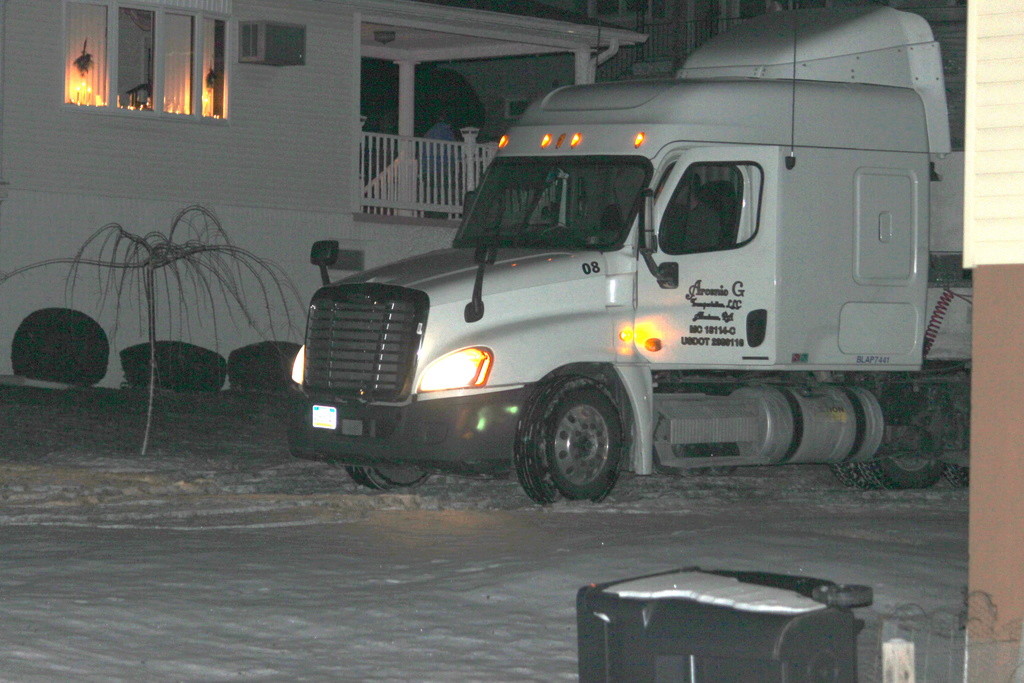
Hey hey hey, when I said I wanted a truck load of snow this is not what I meant!!!!


mikeypizano- Pro Enthusiast

- Posts : 1118
Reputation : 66
Join date : 2017-01-05
Age : 35
Location : Wilkes-Barre/Scranton, PA
 Re: January 4th Mothrazilla: Final Call & Observations
hyde345 wrote:rb924119 wrote:Looking at present WV imagery it looks to me like our establishing low-level circulation is on a "B" line directly WEST of Hatteras. If that trajectory maintains, my god......you'd have your best banding set up as far west as EPa.
RB whats your thought about all the dry air in place in the HV? Is that going to be an issue for us?
Dew points are definitely low, so it's gonna take a fair amount of time to saturate the column. That said, with such a backing flow regime coming off the Atlantic the mid- and lower-levels should steadily saturate as it approaches. The wind direction right now is important; note how it's from the east-south quadrant, and not from the northeast-west third. That's good because that means we aren't having the really cold, dry air drain into our region from New England and Canada.....yet. Not until the low begins getting closer to our latitude.
rb924119- Meteorologist

- Posts : 7103
Reputation : 195
Join date : 2013-02-06
Age : 32
Location : Greentown, Pa
 Re: January 4th Mothrazilla: Final Call & Observations
There's been some chatter over at the other board why the GFS suddenly makes a ENE jog when the low approaches our latitude. With an already negative trough, that would argue for a more northerly trek closer to the coast. On another note, Lee Goldberg mentioned earlier that the snow shield is more west then what the models show. 0z runs will be telling tonight!rb924119 wrote:Looking at present WV imagery it looks to me like our establishing low-level circulation is on a "B" line directly WEST of Hatteras. If that trajectory maintains, my god......you'd have your best banding set up as far west as EPa.

nutleyblizzard- Senior Enthusiast

- Posts : 1963
Reputation : 41
Join date : 2014-01-30
Age : 58
Location : Nutley, new jersey
 Re: January 4th Mothrazilla: Final Call & Observations
yes Hyde that dry air plus a arctic front Albany talked about could be a problem for us, but I still like right now 3-6 for us.
jimv45- Senior Enthusiast

- Posts : 1168
Reputation : 36
Join date : 2013-09-20
Location : Hopewell jct.
 Re: January 4th Mothrazilla: Final Call & Observations

_________________
_______________________________________________________________________________________________________
CLICK HERE to view NJ Strong Snowstorm Classifications
 Re: January 4th Mothrazilla: Final Call & Observations
I have to say, after reading Ray's post I took a look at the satellite/radar and it sure does look like the low center is tracking inside of Hatteras.

billg315- Advanced Forecaster - Mod

- Posts : 4558
Reputation : 185
Join date : 2015-01-24
Age : 50
Location : Flemington, NJ
 Re: January 4th Mothrazilla: Final Call & Observations
Last night I noted how close the low center was to Hatteras on a couple of models, but it was still offshore -- not west of Hatteras. It's interesting that everything real-time today, radar, satellite, pressure centers seems slightly west of where it was on the models.

billg315- Advanced Forecaster - Mod

- Posts : 4558
Reputation : 185
Join date : 2015-01-24
Age : 50
Location : Flemington, NJ
 Re: January 4th Mothrazilla: Final Call & Observations
Frank, looking at that radar we could have precipitation over us by about 10 pm, no? That's about 5-6 hours early. lol

billg315- Advanced Forecaster - Mod

- Posts : 4558
Reputation : 185
Join date : 2015-01-24
Age : 50
Location : Flemington, NJ
 Re: January 4th Mothrazilla: Final Call & Observations
So wait, if the low tracks west of Hatteras, does that mean I am likely to jackpot?

mikeypizano- Pro Enthusiast

- Posts : 1118
Reputation : 66
Join date : 2017-01-05
Age : 35
Location : Wilkes-Barre/Scranton, PA
 Re: January 4th Mothrazilla: Final Call & Observations
No big deal, even the NAM is only about 300 miles too far southeast with its progged jet for 00z. Meh, that won't change the forecast at all ahaha
rb924119- Meteorologist

- Posts : 7103
Reputation : 195
Join date : 2013-02-06
Age : 32
Location : Greentown, Pa
 Re: January 4th Mothrazilla: Final Call & Observations
Wow a call on NYC schools before morning wow.

jmanley32- Senior Enthusiast

- Posts : 20645
Reputation : 108
Join date : 2013-12-12
Age : 43
Location : Yonkers, NY
 Re: January 4th Mothrazilla: Final Call & Observations
billg315 wrote:Frank, looking at that radar we could have precipitation over us by about 10 pm, no? That's about 5-6 hours early. lol
In my write up I said 1 to 3 am from south to north. May start as virga
_________________
_______________________________________________________________________________________________________
CLICK HERE to view NJ Strong Snowstorm Classifications
 Re: January 4th Mothrazilla: Final Call & Observations
rb924119 wrote:No big deal, even the NAM is only about 300 miles too far southeast with its progged jet for 00z. Meh, that won't change the forecast at all ahaha
lol. so true. and I was being kind to the models when I said "slightly" west of the models

billg315- Advanced Forecaster - Mod

- Posts : 4558
Reputation : 185
Join date : 2015-01-24
Age : 50
Location : Flemington, NJ
 Re: January 4th Mothrazilla: Final Call & Observations
nutleyblizzard wrote:There's been some chatter over at the other board why the GFS suddenly makes a ENE jog when the low approaches our latitude. With an already negative trough, that would argue for a more northerly trek closer to the coast. On another note, Lee Goldberg mentioned earlier that the snow shield is more west then what the models show. 0z runs will be telling tonight!rb924119 wrote:Looking at present WV imagery it looks to me like our establishing low-level circulation is on a "B" line directly WEST of Hatteras. If that trajectory maintains, my god......you'd have your best banding set up as far west as EPa.
Agree!! The closing off of H5 alone argues against that, but even if it does, the precip shield should not be negatively impacted. Throw in what our current jet looks like and I'm just slightly inclined to say that jump doesn't make sense, and the precip should be healthier than modeled further to the west.
rb924119- Meteorologist

- Posts : 7103
Reputation : 195
Join date : 2013-02-06
Age : 32
Location : Greentown, Pa
 Re: January 4th Mothrazilla: Final Call & Observations
mikeypizano wrote:So wait, if the low tracks west of Hatteras, does that mean I am likely to jackpot?
*IF* it does, you might not technically jackpot, but you'd likely more than double your 2-4" forecast from the NWS lol
rb924119- Meteorologist

- Posts : 7103
Reputation : 195
Join date : 2013-02-06
Age : 32
Location : Greentown, Pa
 Re: January 4th Mothrazilla: Final Call & Observations
Frank_Wx wrote:billg315 wrote:Frank, looking at that radar we could have precipitation over us by about 10 pm, no? That's about 5-6 hours early. lol
In my write up I said 1 to 3 am from south to north. May start as virga
Yeah, it definitely would still be on target with what you said in your write-up. I was thinking more of where the models and other forecasters had this thing projected earlier today. It seems accelerated from those projections.

billg315- Advanced Forecaster - Mod

- Posts : 4558
Reputation : 185
Join date : 2015-01-24
Age : 50
Location : Flemington, NJ
 Re: January 4th Mothrazilla: Final Call & Observations
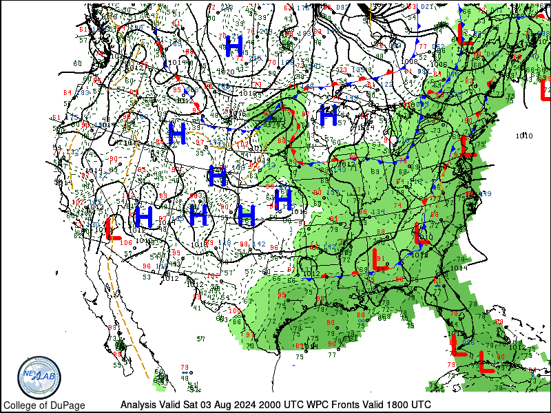
Hmmmmmmm

_________________
_______________________________________________________________________________________________________
CLICK HERE to view NJ Strong Snowstorm Classifications
 Re: January 4th Mothrazilla: Final Call & Observations
Hmmmm good or hmmmm bad?
lglickman1- Pro Enthusiast

- Posts : 319
Reputation : 0
Join date : 2013-02-05
Location : New Rochelle, NY
Page 2 of 32 •  1, 2, 3 ... 17 ... 32
Page 2 of 32
Permissions in this forum:
You cannot reply to topics in this forum
 Home
Home