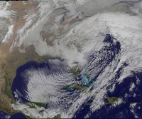
01/22/16 - 01/23/16 Update #3 - Will Models Trend Back North?
+54
static2987
Sparky Sparticles
H.G. Rising
lglickman1
deadrabbit79
Taffy
gigs68
Scullybutcher
crippo84
aiannone
Radz
hyde345
essexcountypete
Quietace
sroc4
billg315
SNOW MAN
Snowfall
Snow88
Sunflowers138
oldtimer
mako460
Dtone
Abba701
jake732
HEATMISER
WeatherBob
algae888
Artechmetals
Dis2cruise
Ferndue21
jimv45
CPcantmeasuresnow
Vinnydula
Joe Snow
justin92
chief7
weatherwatchermom
SoulSingMG
Math23x7
nutleyblizzard
pdubz
frank 638
skinsfan1177
jmanley32
NjWeatherGuy
devsman
Biggin23
amugs
RJB8525
snow247
WeatherJeff1224
rb924119
Frank_Wx
58 posters
Page 29 of 35
Page 29 of 35 •  1 ... 16 ... 28, 29, 30 ... 35
 Re: 01/22/16 - 01/23/16 Update #3 - Will Models Trend Back North?
It barely moves from 45-48 I think it might capture
NjWeatherGuy- Advanced Forecaster

- Posts : 4100
Join date : 2013-01-06
 Re: 01/22/16 - 01/23/16 Update #3 - Will Models Trend Back North?
amugs wrote:amugs wrote:EPS mean - North of 0Z - excellent trend still going
KNYC 13
CNJ 17
North of NYC 6-12" - tight gradient - every 10 -25 mile jog is going to be huge for some members here
Eps are much improved aloft and at the surface.Definitive bump n and w.
Mugs can you unlock the snow maps thread for me? thanks.
snow247- Pro Enthusiast

- Posts : 2417
Join date : 2014-08-27

NjWeatherGuy- Advanced Forecaster

- Posts : 4100
Reputation : 28
Join date : 2013-01-06
Location : Belle Mead, NJ
 Re: 01/22/16 - 01/23/16 Update #3 - Will Models Trend Back North?
algae888 wrote:nws snow map...
through 7am sat
Looks like they cut back from this morning?

snow247- Pro Enthusiast

- Posts : 2417
Reputation : 0
Join date : 2014-08-27
Location : Mount Ivy, NY - Elevation 545'
 Re: 01/22/16 - 01/23/16 Update #3 - Will Models Trend Back North?
i was going to post mt holly/philly snow map but they haven't updated it since 8am this morning

RJB8525- Senior Enthusiast

- Posts : 1994
Reputation : 28
Join date : 2013-02-06
Age : 38
Location : Hackettstown, NJ
 Re: 01/22/16 - 01/23/16 Update #3 - Will Models Trend Back North?
essexcountypete wrote:snow247 wrote:essexcountypete wrote:snow247 wrote:Going by the models today, I'll be getting flurries while places 20 miles south of me get 12"-24"+.
Sick.
Btw, can someone open the snow map thread? I have a first call to post.
Already open...
https://www.njstrongweatherforum.com/t635-jan-23rd-24th-2016-snow-maps-only
I know, it's locked.
So it is. Odd.
no the mods said earlier they going to keep it locked, post your snow maps here and they will move it to that thread. They do not want any comments in that thread.

jmanley32- Senior Enthusiast

- Posts : 20648
Reputation : 108
Join date : 2013-12-12
Age : 43
Location : Yonkers, NY
 Re: 01/22/16 - 01/23/16 Update #3 - Will Models Trend Back North?
Okay boys, just put out hot off the press
WINTER STORM WATCH IN EFFECT FROM LATE FRIDAY NIGHT THROUGH SUNDAY MORNING...
THE NATIONAL WEATHER SERVICE IN MOUNT HOLLY HAS ISSUED A WINTER STORM WATCH... WHICH IS IN EFFECT FROM LATE FRIDAY NIGHT THROUGH SUNDAY MORNING.
* LOCATIONS... FAR NORTHERN SUBURBS OF PHILADELPHIA... LEHIGH VALLEY... SOUTHERN POCONOS... AND NORTHWESTERN NEW JERSEY.
* HAZARD TYPES... HEAVY SNOW.
* SNOW ACCUMULATIONS... 4 TO 8 INCHES.
* TIMING... SNOW IS EXPECTED TO BEGIN FRIDAY NIGHT... THEN CONTINUE HEAVY AT TIMES INTO SUNDAY MORNING.
* IMPACTS... SNOW MAY BE DRY AND PUFFY AT THE START, BUT WILL BECOME WETTER AND HEAVIER AS THE EVENT UNFOLDS. SHOVELING MAY BE PROBLEMATIC FOR THOSE WITH PHYSICAL AILMENTS. SNOW MAY CLING TO WIRES AND TREES WHICH MAY CAUSE POWER OUTAGES. ROADS WILL BECOME IMPASSABLE DUE TO INCREASING ACCUMULATION DURING THE EVENT.
* WINDS... NORTHEAST 15 TO 25 MPH WITH GUSTS UP TO 35 MPH.

RJB8525- Senior Enthusiast

- Posts : 1994
Reputation : 28
Join date : 2013-02-06
Age : 38
Location : Hackettstown, NJ
 Re: 01/22/16 - 01/23/16 Update #3 - Will Models Trend Back North?
jmanley32 wrote:essexcountypete wrote:snow247 wrote:essexcountypete wrote:snow247 wrote:Going by the models today, I'll be getting flurries while places 20 miles south of me get 12"-24"+.
Sick.
Btw, can someone open the snow map thread? I have a first call to post.
Already open...
https://www.njstrongweatherforum.com/t635-jan-23rd-24th-2016-snow-maps-only
I know, it's locked.
So it is. Odd.
no the mods said earlier they going to keep it locked, post your snow maps here and they will move it to that thread. They do not want any comments in that thread.
Must have missed that, thanks jman.

snow247- Pro Enthusiast

- Posts : 2417
Reputation : 0
Join date : 2014-08-27
Location : Mount Ivy, NY - Elevation 545'
 Re: 01/22/16 - 01/23/16 Update #3 - Will Models Trend Back North?
Holly Went With WSW. Understandable conservative approach at this time. Will be updated quickly if 0z Models hold.

Quietace- Meteorologist - Mod

- Posts : 3689
Reputation : 33
Join date : 2013-01-07
Age : 27
Location : Point Pleasant, NJ
 Re: 01/22/16 - 01/23/16 Update #3 - Will Models Trend Back North?
Upton will be the last to chime in on advisories or warnings especially NYC and southern WC, for some reason they always seem to put this area last, always wondered why.

jmanley32- Senior Enthusiast

- Posts : 20648
Reputation : 108
Join date : 2013-12-12
Age : 43
Location : Yonkers, NY
 Re: 01/22/16 - 01/23/16 Update #3 - Will Models Trend Back North?
Quietace wrote:Holly Went With WSW. Understandable conservative approach at this time. Will be updated quickly if 0z Models hold.
Interesting that Monmouth county is put in the same WSW as the Poconos and not in the watch that includes Ocean county lol. I'm just going to assume that'll be changing
Sanchize06- Senior Enthusiast

- Posts : 1041
Reputation : 21
Join date : 2013-02-05
Location : Union Beach, NJ
 Re: 01/22/16 - 01/23/16 Update #3 - Will Models Trend Back North?
Broad brushed it ATM. Only included snow totals for Friday/Friday Night on advisories. We might get 3-5 in the first few hours of the system.Sanchize06 wrote:Quietace wrote:Holly Went With WSW. Understandable conservative approach at this time. Will be updated quickly if 0z Models hold.
Interesting that Monmouth county is put in the same WSW as the Poconos and not in the watch that includes Ocean county lol. I'm just going to assume that'll be changing

Quietace- Meteorologist - Mod

- Posts : 3689
Reputation : 33
Join date : 2013-01-07
Age : 27
Location : Point Pleasant, NJ
 Re: 01/22/16 - 01/23/16 Update #3 - Will Models Trend Back North?
NWS disco talks a lot about p-type issues and is very concservative on snow amounts mainly staying below 8 inches for all of upton discussion area. I'd think this will change after 00z goods, and I am pretty sure the models tonight will have us all sleeping happy dreams. crossing fingers, spoons under pillow lol

jmanley32- Senior Enthusiast

- Posts : 20648
Reputation : 108
Join date : 2013-12-12
Age : 43
Location : Yonkers, NY
 Re: 01/22/16 - 01/23/16 Update #3 - Will Models Trend Back North?
jmanley32 wrote:Upton will be the last to chime in on advisories or warnings especially NYC and southern WC, for some reason they always seem to put this area last, always wondered why.
They have to give DeBlasio 24 hours in advance for any type of warnings are issued for his excuse on how poor the cleanup was

RJB8525- Senior Enthusiast

- Posts : 1994
Reputation : 28
Join date : 2013-02-06
Age : 38
Location : Hackettstown, NJ
 Re: 01/22/16 - 01/23/16 Update #3 - Will Models Trend Back North?
snow247 wrote:My first call.
I will move it to the snow maps thread once someone unlocks it.
I posted this in the Snow maps thread. Nice job! Anyone else who wants to make a map post in in here and one of us will move it over.
_________________
"In weather and in life, there's no winning and losing; there's only winning and learning."
WINTER 2012/2013 TOTALS 43.65"WINTER 2017/2018 TOTALS 62.85" WINTER 2022/2023 TOTALS 4.9"
WINTER 2013/2014 TOTALS 64.85"WINTER 2018/2019 TOTALS 14.25" WINTER 2023/2024 TOTALS 13.1"
WINTER 2014/2015 TOTALS 71.20"WINTER 2019/2020 TOTALS 6.35" WINTER 2024/2025 TOTALS 0.00
WINTER 2015/2016 TOTALS 35.00"WINTER 2020/2021 TOTALS 37.75"
WINTER 2016/2017 TOTALS 42.25"WINTER 2021/2022 TOTALS 31.65"

sroc4- Admin

- Posts : 8463
Reputation : 302
Join date : 2013-01-07
Location : Wading River, LI
 Re: 01/22/16 - 01/23/16 Update #3 - Will Models Trend Back North?
Thanks sroc.
18z NAM is rolling, looks like about the same as 12z.
18z NAM is rolling, looks like about the same as 12z.

snow247- Pro Enthusiast

- Posts : 2417
Reputation : 0
Join date : 2014-08-27
Location : Mount Ivy, NY - Elevation 545'
 Re: 01/22/16 - 01/23/16 Update #3 - Will Models Trend Back North?
New Discsusion out, Holly saying 12-16 inside I-95 corridor, mixing limited to Delmarva.Sanchize06 wrote:Quietace wrote:Holly Went With WSW. Understandable conservative approach at this time. Will be updated quickly if 0z Models hold.
Interesting that Monmouth county is put in the same WSW as the Poconos and not in the watch that includes Ocean county lol. I'm just going to assume that'll be changing

Quietace- Meteorologist - Mod

- Posts : 3689
Reputation : 33
Join date : 2013-01-07
Age : 27
Location : Point Pleasant, NJ
 Re: 01/22/16 - 01/23/16 Update #3 - Will Models Trend Back North?
Ouch! nice job but I think the numbers will tick up. Or to re-phrase that, I HOPE the numbers tick up.
mako460- Pro Enthusiast

- Posts : 346
Reputation : 4
Join date : 2013-01-09
Age : 58
Location : Gerritsen Beach Brooklyn
 Re: 01/22/16 - 01/23/16 Update #3 - Will Models Trend Back North?
Looks SE of 12z, great.

snow247- Pro Enthusiast

- Posts : 2417
Reputation : 0
Join date : 2014-08-27
Location : Mount Ivy, NY - Elevation 545'
 Re: 01/22/16 - 01/23/16 Update #3 - Will Models Trend Back North?
Scullybutcher wrote:Why do you guys think ratios will be higher then 10-1. It's a lot of moisture and the temps will be right around freezing. I think it will be a wet heavy snow which should keep totals around 10-1.
Scully it will depend on where we are talking about to determine ratios. The immediate coast will most likely see ratios at or around 10:1(+/-). As soon as your away from the coast the Surface temps look no warmer than upper 20's and the mid levels, 925mb/850mb are -6 to -12 so higher ratios possible/likely in those areas.
Last edited by sroc4 on Wed Jan 20, 2016 3:42 pm; edited 1 time in total
_________________
"In weather and in life, there's no winning and losing; there's only winning and learning."
WINTER 2012/2013 TOTALS 43.65"WINTER 2017/2018 TOTALS 62.85" WINTER 2022/2023 TOTALS 4.9"
WINTER 2013/2014 TOTALS 64.85"WINTER 2018/2019 TOTALS 14.25" WINTER 2023/2024 TOTALS 13.1"
WINTER 2014/2015 TOTALS 71.20"WINTER 2019/2020 TOTALS 6.35" WINTER 2024/2025 TOTALS 0.00
WINTER 2015/2016 TOTALS 35.00"WINTER 2020/2021 TOTALS 37.75"
WINTER 2016/2017 TOTALS 42.25"WINTER 2021/2022 TOTALS 31.65"

sroc4- Admin

- Posts : 8463
Reputation : 302
Join date : 2013-01-07
Location : Wading River, LI
 Re: 01/22/16 - 01/23/16 Update #3 - Will Models Trend Back North?
Quietace wrote:Broad brushed it ATM. Only included snow totals for Friday/Friday Night on advisories. We might get 3-5 in the first few hours of the system.Sanchize06 wrote:Quietace wrote:Holly Went With WSW. Understandable conservative approach at this time. Will be updated quickly if 0z Models hold.
Interesting that Monmouth county is put in the same WSW as the Poconos and not in the watch that includes Ocean county lol. I'm just going to assume that'll be changing
Oh okay, that makes more sense then
Sanchize06- Senior Enthusiast

- Posts : 1041
Reputation : 21
Join date : 2013-02-05
Location : Union Beach, NJ
 Re: 01/22/16 - 01/23/16 Update #3 - Will Models Trend Back North?
NAM hits the proverbial wall just north of I 287 in NY State


_________________
Mugs
AKA:King: Snow Weenie
Self Proclaimed
WINTER 2014-15 : 55.12" +.02 for 6 coatings (avg. 35")
WINTER 2015-16 Total - 29.8" (Avg 35")
WINTER 2016-17 : 39.5" so far

amugs- Advanced Forecaster - Mod

- Posts : 15157
Reputation : 213
Join date : 2013-01-07
Age : 54
Location : Hillsdale,NJ
 Re: 01/22/16 - 01/23/16 Update #3 - Will Models Trend Back North?
the NASM overdoing it a tad - this wopuld be 3-5" rates per hour plus in that dark blue band!!


_________________
Mugs
AKA:King: Snow Weenie
Self Proclaimed
WINTER 2014-15 : 55.12" +.02 for 6 coatings (avg. 35")
WINTER 2015-16 Total - 29.8" (Avg 35")
WINTER 2016-17 : 39.5" so far

amugs- Advanced Forecaster - Mod

- Posts : 15157
Reputation : 213
Join date : 2013-01-07
Age : 54
Location : Hillsdale,NJ
 Re: 01/22/16 - 01/23/16 Update #3 - Will Models Trend Back North?
Quietace wrote:New Discsusion out, Holly saying 12-16 inside I-95 corridor, mixing limited to Delmarva.Sanchize06 wrote:Quietace wrote:Holly Went With WSW. Understandable conservative approach at this time. Will be updated quickly if 0z Models hold.
Interesting that Monmouth county is put in the same WSW as the Poconos and not in the watch that includes Ocean county lol. I'm just going to assume that'll be changing
Yep, I probably should have read the discussion in the beginning instead of just the watch haha. And yeah I think we can pretty much forget about any mixing issues unless the low moves over SNJ
Sanchize06- Senior Enthusiast

- Posts : 1041
Reputation : 21
Join date : 2013-02-05
Location : Union Beach, NJ
 Re: 01/22/16 - 01/23/16 Update #3 - Will Models Trend Back North?
Upton just increased their maps into sat night 6-8 NYC.

jmanley32- Senior Enthusiast

- Posts : 20648
Reputation : 108
Join date : 2013-12-12
Age : 43
Location : Yonkers, NY
 Re: 01/22/16 - 01/23/16 Update #3 - Will Models Trend Back North?
amugs wrote:the NASM overdoing it a tad - this wopuld be 3-5" rates per hour plus in that dark blue band!!
dear lord please let this come true I win the mega jackpot! As do many others too. But its the NAM show this tomorrow into Fri then ill be jumping
Last edited by jmanley32 on Wed Jan 20, 2016 3:46 pm; edited 1 time in total

jmanley32- Senior Enthusiast

- Posts : 20648
Reputation : 108
Join date : 2013-12-12
Age : 43
Location : Yonkers, NY
 Re: 01/22/16 - 01/23/16 Update #3 - Will Models Trend Back North?
NYC and LI and parts of NNJ get absolutely smoked it this 6 hour timeframe


Last edited by amugs on Wed Jan 20, 2016 3:46 pm; edited 1 time in total
_________________
Mugs
AKA:King: Snow Weenie
Self Proclaimed
WINTER 2014-15 : 55.12" +.02 for 6 coatings (avg. 35")
WINTER 2015-16 Total - 29.8" (Avg 35")
WINTER 2016-17 : 39.5" so far

amugs- Advanced Forecaster - Mod

- Posts : 15157
Reputation : 213
Join date : 2013-01-07
Age : 54
Location : Hillsdale,NJ
Page 29 of 35 •  1 ... 16 ... 28, 29, 30 ... 35
Page 29 of 35
Permissions in this forum:
You cannot reply to topics in this forum
 Home
Home
