01/23/16 Storm Update #5 - It Is What It Is, Or Is It?
+70
smoggy14
Ronniek
GreyBeard
Cyanide02Z06
bloc1357
deadrabbit79
sabamfa
gigs68
Quietace
oldtimer
WOLVES1
JoeBx82
Snow88
algae888
pdubz
Artechmetals
docstox12
dad4twoboys
Scullybutcher
Abba701
Deweydave
Joe Snow
jake732
skinsfan1177
Vinnydula
Bkdude
pkmak
nutleyblizzard
kaos00723
dkodgis
2004blackwrx
weatherwatchermom
Grselig
hyde345
Dtone
essexcountypete
lglickman1
jimv45
amugs
Radz
Taffy
devsman
Dunnzoo
Snowfall
SoulSingMG
crippo84
Mathgod55
mako460
meeka312
NjWeatherGuy
Biggin23
Fededle22
snowlover78
CPcantmeasuresnow
Mac003
dsvinos
jmanley32
Math23x7
billg315
Aiosamoney21
mwilli5783
HEATMISER
sroc4
RJB8525
snowlover 12345
frank 638
snow247
rb924119
nancy-j-s
Frank_Wx
74 posters
Page 22 of 41
Page 22 of 41 •  1 ... 12 ... 21, 22, 23 ... 31 ... 41
 Re: 01/23/16 Storm Update #5 - It Is What It Is, Or Is It?
Looks like a pretty good ridge out west. Am I looking at that correctly?
billg315- Advanced Forecaster - Mod

- Posts : 4562
Join date : 2015-01-24
 Re: 01/23/16 Storm Update #5 - It Is What It Is, Or Is It?
billg315 wrote:Looks like a pretty good ridge out west. Am I looking at that correctly?
Absolutely correct. Looks great
sroc4- Admin

- Posts : 8458
Join date : 2013-01-07
 Re: 01/23/16 Storm Update #5 - It Is What It Is, Or Is It?
I think we will do fine even if a little mix occurs but many saying that snj. We are in a great spotBiggin23 wrote:If I don't mix I'm well over a foot, if I do mix probably around 8 inches. Going to be close....I'm 20 miles east of Trenton and about 15 from the shore as a crow flys

skinsfan1177- Senior Enthusiast

- Posts : 4485
Reputation : 35
Join date : 2013-01-07
Age : 47
Location : Point Pleasant Boro
 Re: 01/23/16 Storm Update #5 - It Is What It Is, Or Is It?
Been through a lot of these storms here on coast and if it stays snow we usually over achieve

skinsfan1177- Senior Enthusiast

- Posts : 4485
Reputation : 35
Join date : 2013-01-07
Age : 47
Location : Point Pleasant Boro
 Re: 01/23/16 Storm Update #5 - It Is What It Is, Or Is It?
sroc4 wrote:billg315 wrote:Looks like a pretty good ridge out west. Am I looking at that correctly?
Absolutely correct. Looks great
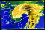
Will the low follow the flow depicted on the east coast? Exit stage right?
Radz- Pro Enthusiast

- Posts : 1028
Reputation : 17
Join date : 2013-01-12
Location : Cortlandt Manor NY
 Re: 01/23/16 Storm Update #5 - It Is What It Is, Or Is It?
Actually if the ridge stays strong out west with a deep trough east it favors the storm not running off the east coast but holding closer to the coast. If ridge was weak out west more likely the storm would go east rather than northeast.

billg315- Advanced Forecaster - Mod

- Posts : 4562
Reputation : 185
Join date : 2015-01-24
Age : 50
Location : Flemington, NJ
 Re: 01/23/16 Storm Update #5 - It Is What It Is, Or Is It?
billg315 wrote:Actually if the ridge stays strong out west with a deep trough east it favors the storm not running off the east coast but holding closer to the coast. If ridge was weak out west more likely the storm would go east rather than northeast.
Thanks, staying optimistic- That H5 looked like a road map

Radz- Pro Enthusiast

- Posts : 1028
Reputation : 17
Join date : 2013-01-12
Location : Cortlandt Manor NY
 Re: 01/23/16 Storm Update #5 - It Is What It Is, Or Is It?
This is probably a bad explanation so someone can correct me, but picture a hose or string curved in that shape with a ridge to the left and a trough to the right. If you start to push down on the high part of the hose/string on your left, it will flatten/straighten out the part on your right. With a flatter flow the storm is more likely to get carried out eastward rather than coming up north, and it also is likely to be weaker and more spread out. Ok, now the real mets on here can correct this poor explanation. Lol.

billg315- Advanced Forecaster - Mod

- Posts : 4562
Reputation : 185
Join date : 2015-01-24
Age : 50
Location : Flemington, NJ
 Re: 01/23/16 Storm Update #5 - It Is What It Is, Or Is It?
Since I am at work a final call snow map / update will not come until later this evening. I have a strong suspicion I will be increasing snowfall amounts across the board, even adding in an 18+ areas for southern sections of the coverage region. The EURO jumped aboard the north trend last night and the NAM model - unbelievably - as the hot hand. Today should be very interesting 12z runs.
_________________
_______________________________________________________________________________________________________
CLICK HERE to view NJ Strong Snowstorm Classifications
 Re: 01/23/16 Storm Update #5 - It Is What It Is, Or Is It?
Jesus, SREFS just got WETTER!

SoulSingMG- Senior Enthusiast

- Posts : 2853
Reputation : 74
Join date : 2013-12-11
Location : Long Island City, NY

SoulSingMG- Senior Enthusiast

- Posts : 2853
Reputation : 74
Join date : 2013-12-11
Location : Long Island City, NY
 Re: 01/23/16 Storm Update #5 - It Is What It Is, Or Is It?
SoulSingMG wrote:
NWS totally not buying this for my area in the HV.They have me down for 2 to 4,LOL

docstox12- Wx Statistician Guru

- Posts : 8615
Reputation : 222
Join date : 2013-01-07
Age : 74
Location : Monroe NY
 Re: 01/23/16 Storm Update #5 - It Is What It Is, Or Is It?
Regardless of what will happen, based on radar and the HRRR, a wall of white will move into the area from the overrunning snows between 5-10pm South to North. Be off the roads by then. You can clearly see the strength of the system on radar.


Quietace- Meteorologist - Mod

- Posts : 3689
Reputation : 33
Join date : 2013-01-07
Age : 27
Location : Point Pleasant, NJ
 Re: 01/23/16 Storm Update #5 - It Is What It Is, Or Is It?
So whats king NAM say.. LMAO!!
HEATMISER- Posts : 62
Reputation : 0
Join date : 2013-11-22
 Re: 01/23/16 Storm Update #5 - It Is What It Is, Or Is It?
billg315 wrote:This is probably a bad explanation so someone can correct me, but picture a hose or string curved in that shape with a ridge to the left and a trough to the right. If you start to push down on the high part of the hose/string on your left, it will flatten/straighten out the part on your right. With a flatter flow the storm is more likely to get carried out eastward rather than coming up north, and it also is likely to be weaker and more spread out. Ok, now the real mets on here can correct this poor explanation. Lol.
Its a great explantation. Here is a little expantion. First image is the current conditions at 500mb. Currently we have a neutral trough(north to south trough axis) and a beautiful ridge. If you follow the wind barbs you can see the path the LP will take as we move along.

In an ideal world as the 500mb level closes off to form the ULL, upper level low, and the entire ridge/trough complex progresses east, the trough axis begins to tilt into a negative orientation, SE-NW. This would ideally occur as the LP center exits the coast. The 500mb wind barbs would then steer the LP center N before it heads NE.
 " />
" />In our case however, models have been hinting at a shortwave that will be riding over the top of the ridge over the next 24-36hrs.
 " />
" />This is where Billg your explanation comes in. As youll see below this short wave "pushes down" on the ridge which in effect leads the NE quadrant of the ridge to "fold over" the top of the trough.(I used the CMC simply to illustrate the point) This tilts the trough axis positive. Instead of a neg tilted trough which brings the LP center S to N or even back NW in some instances(ie: Sandy) the positively tilted trough creates a more progressive flow out ahead of the LP and directs the LP more SW-NE or even WWSW to ENE.
 " />
" /> The timing of where the ULL is, how strong it is, where the surface LP is and how strong it is, and just how much of a positive tilt occurs over the next 24-36hr, or lack thereof will be crucial in determining how far north the precip shield can make it.
Last edited by sroc4 on Fri Jan 22, 2016 8:41 am; edited 1 time in total
_________________
"In weather and in life, there's no winning and losing; there's only winning and learning."
WINTER 2012/2013 TOTALS 43.65"WINTER 2017/2018 TOTALS 62.85" WINTER 2022/2023 TOTALS 4.9"
WINTER 2013/2014 TOTALS 64.85"WINTER 2018/2019 TOTALS 14.25" WINTER 2023/2024 TOTALS 13.1"
WINTER 2014/2015 TOTALS 71.20"WINTER 2019/2020 TOTALS 6.35" WINTER 2024/2025 TOTALS 0.00
WINTER 2015/2016 TOTALS 35.00"WINTER 2020/2021 TOTALS 37.75"
WINTER 2016/2017 TOTALS 42.25"WINTER 2021/2022 TOTALS 31.65"

sroc4- Admin

- Posts : 8458
Reputation : 302
Join date : 2013-01-07
Location : Wading River, LI
 Re: 01/23/16 Storm Update #5 - It Is What It Is, Or Is It?
I will post my final call map on Sunday around noon. Hope it verifies

gigs68- Posts : 142
Reputation : 3
Join date : 2013-01-16
Location : Commack, NY (NW Suffolk)
 Re: 01/23/16 Storm Update #5 - It Is What It Is, Or Is It?
Quietace wrote:Regardless of what will happen, based on radar and the HRRR, a wall of white will move into the area from the overrunning snows between 5-10pm South to North. Be off the roads by then. You can clearly see the strength of the system on radar.
Moving up the start time?
Guest- Guest
 Re: 01/23/16 Storm Update #5 - It Is What It Is, Or Is It?
What do u think the start time might be for River Edge nj - northern nj. We are sitting for a family member and people will a traveling. Want to make sure we all r safe

Grselig- Senior Enthusiast

- Posts : 1410
Reputation : 140
Join date : 2013-03-04
Age : 54
Location : Wayne NJ
 Re: 01/23/16 Storm Update #5 - It Is What It Is, Or Is It?
hot damn!SoulSingMG wrote:

jmanley32- Senior Enthusiast

- Posts : 20646
Reputation : 108
Join date : 2013-12-12
Age : 43
Location : Yonkers, NY
 Re: 01/23/16 Storm Update #5 - It Is What It Is, Or Is It?
sroc4 wrote:billg315 wrote:This is probably a bad explanation so someone can correct me, but picture a hose or string curved in that shape with a ridge to the left and a trough to the right. If you start to push down on the high part of the hose/string on your left, it will flatten/straighten out the part on your right. With a flatter flow the storm is more likely to get carried out eastward rather than coming up north, and it also is likely to be weaker and more spread out. Ok, now the real mets on here can correct this poor explanation. Lol.
Its a great explantation. Here is a little expantion. First image is the current conditions at 500mb. Currently we have a neutral trough(north to south trough axis) and a beautiful ridge. If you follow the wind barbs you can see the path the LP will take as we move along.
In an ideal world as the 500mb level closes off to form the ULL, upper level low, and the entire ridge/trough complex progresses east, the trough axis begins to tilt into a negative orientation, SE-NW. This would ideally occur as the LP center exits the coast. The 500mb wind barbs would then steer the LP center N before it heads NE." />
In our case however, models have been hinting at a shortwave that will be riding over the top of the ridge over the next 24-36hrs." />
This is where Billg your explanation comes in. As youll see below this short wave "pushes down" on the ridge which in effect leads the NE quadrant of the ridge to "fold over" the top of the trough.(I used the CMC simply to illustrate the point) This tilts the trough axis positive. Instead of a neg tilted trough which brings the LP center S to N or even back NW in some instances(ie: Sandy) the positively tilted trough creates a more progressive flow out ahead of the LP and directs the LP more SW-NE or even WWSW to ENE." />
The timing of where the ULL is, how strong it is, where the surface LP is and how strong it is, and just how much of a positive tilt occurs over the next 24-36hr, or lack thereof will be crucial in determining how far north the precip shield can make it.
Excellent Doc with Billg contributing.Now I understand why this storm heads more E than N.

docstox12- Wx Statistician Guru

- Posts : 8615
Reputation : 222
Join date : 2013-01-07
Age : 74
Location : Monroe NY
 Re: 01/23/16 Storm Update #5 - It Is What It Is, Or Is It?
Quietace wrote:Regardless of what will happen, based on radar and the HRRR, a wall of white will move into the area from the overrunning snows between 5-10pm South to North. Be off the roads by then. You can clearly see the strength of the system on radar.
In your opinion, is the storm moving much faster than originally anticipated? I remember yesterday was a start time of Saturday morning. Will it move through quickly or do you think we will snow until Sunday? I'm in Marlboro, western Monmouth county. Thanks!

dsvinos- Posts : 68
Reputation : 4
Join date : 2014-01-02
Age : 56
Location : Marlboro NJ
 Re: 01/23/16 Storm Update #5 - It Is What It Is, Or Is It?
All you hear today are Crickets here !!
HEATMISER- Posts : 62
Reputation : 0
Join date : 2013-11-22
 Re: 01/23/16 Storm Update #5 - It Is What It Is, Or Is It?
Quietace wrote:Regardless of what will happen, based on radar and the HRRR, a wall of white will move into the area from the overrunning snows between 5-10pm South to North. Be off the roads by then. You can clearly see the strength of the system on radar.
Will the radar start lighting up before we actually see flakes flying? Takes time to overcome the dry air, yes?

essexcountypete- Pro Enthusiast

- Posts : 783
Reputation : 12
Join date : 2013-12-09
Location : Bloomfield, NJ
 Re: 01/23/16 Storm Update #5 - It Is What It Is, Or Is It?
HEATMISER wrote:All you hear today are Crickets here !!
Most were up until the wee hours of the morning and some (like me) had a couple of drinks!! I bet everyone is snoring right now!!

dsvinos- Posts : 68
Reputation : 4
Join date : 2014-01-02
Age : 56
Location : Marlboro NJ
 Re: 01/23/16 Storm Update #5 - It Is What It Is, Or Is It?
NAM looking even better so far.

snow247- Pro Enthusiast

- Posts : 2417
Reputation : 0
Join date : 2014-08-27
Location : Mount Ivy, NY - Elevation 545'
 Re: 01/23/16 Storm Update #5 - It Is What It Is, Or Is It?
12z NAM is coming in


_________________
_______________________________________________________________________________________________________
CLICK HERE to view NJ Strong Snowstorm Classifications
 Re: 01/23/16 Storm Update #5 - It Is What It Is, Or Is It?

_________________
_______________________________________________________________________________________________________
CLICK HERE to view NJ Strong Snowstorm Classifications
Page 22 of 41 •  1 ... 12 ... 21, 22, 23 ... 31 ... 41
Page 22 of 41
Permissions in this forum:
You cannot reply to topics in this forum
 Home
Home