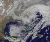
01/22/16-01/23/16 Update #1 - Historic Storm Possible
+45
nnjwxguy78
lglickman1
jwalsh
Teetghhuhnbhj
Sunflowers138
Dave1978
devsman
Cyanide02Z06
Grselig
track17
Dunnzoo
Dtone
CPcantmeasuresnow
weatherwatchermom
aiannone
jimv45
Biggin23
billg315
docstox12
Quietace
GreyBeard
RJB8525
Snowfall
frank 638
Joe Snow
SNOW MAN
jmanley32
chief7
rb924119
Artechmetals
Math23x7
algae888
Abba701
SoulSingMG
sroc4
mako460
skinsfan1177
nutleyblizzard
jake732
amugs
oldtimer
hyde345
snow247
NjWeatherGuy
Frank_Wx
49 posters
Page 22 of 26
Page 22 of 26 •  1 ... 12 ... 21, 22, 23, 24, 25, 26
 Re: 01/22/16-01/23/16 Update #1 - Historic Storm Possible
oldtimer wrote:Is the timing more like Sat-Sun then Fri ??
No, late Friday into Saturday
 Re: 01/22/16-01/23/16 Update #1 - Historic Storm Possible
Anyone see the CIPS analogs? Apparently they're epic. I'm not even sure what the hell they are...? Lol

SoulSingMG- Senior Enthusiast

- Posts : 2853
Reputation : 74
Join date : 2013-12-11
Location : Long Island City, NY
 Re: 01/22/16-01/23/16 Update #1 - Historic Storm Possible
Expect shifts to continue.
_________________
_______________________________________________________________________________________________________
CLICK HERE to view NJ Strong Snowstorm Classifications
 Re: 01/22/16-01/23/16 Update #1 - Historic Storm Possible
I'm hoping it doesn't mean too much and it probably doesn't this far out but almost every run today , especially this last one has most of the western 2/3 of long island in a precip hole. Areas west and south as well as east and north get more than double the QPF. I know it's the op runs but any validity to this? Or is it just way too difficult to pin down at this point which is how I feel
Guest- Guest
 Re: 01/22/16-01/23/16 Update #1 - Historic Storm Possible
LOOKY SEE EVERY BLIZZARD FOR NE EVVVVVVVER CANSIPS ANALOGS - MOMMA MIA 2 X OVER
http://www.eas.slu.edu/CIPS/ANALOG/DFHR.php?reg=EC&fhr=F120&rundt=2016011812
http://www.eas.slu.edu/CIPS/ANALOG/DFHR.php?reg=EC&fhr=F120&rundt=2016011812
_________________
Mugs
AKA:King: Snow Weenie
Self Proclaimed
WINTER 2014-15 : 55.12" +.02 for 6 coatings (avg. 35")
WINTER 2015-16 Total - 29.8" (Avg 35")
WINTER 2016-17 : 39.5" so far

amugs- Advanced Forecaster - Mod

- Posts : 15154
Reputation : 213
Join date : 2013-01-07
Age : 54
Location : Hillsdale,NJ
 Re: 01/22/16-01/23/16 Update #1 - Historic Storm Possible
SoulSingMG wrote:Anyone see the CIPS analogs? Apparently they're epic. I'm not even sure what the hell they are...? Lol
They find the top 15 analogs this setup best resembles and male an impact map out of it. They were very accurate last year. Here is what they're thinking. AMAZING

_________________
_______________________________________________________________________________________________________
CLICK HERE to view NJ Strong Snowstorm Classifications
 Re: 01/22/16-01/23/16 Update #1 - Historic Storm Possible
Frank_Wx wrote:So...18z GFS was incredible
Yes, yes it was

NjWeatherGuy- Advanced Forecaster

- Posts : 4100
Reputation : 28
Join date : 2013-01-06
Location : Belle Mead, NJ
 Re: 01/22/16-01/23/16 Update #1 - Historic Storm Possible
Frank_Wx wrote:SoulSingMG wrote:Anyone see the CIPS analogs? Apparently they're epic. I'm not even sure what the hell they are...? Lol
They find the top 15 analogs this setup best resembles and male an impact map out of it. They were very accurate last year. Here is what they're thinking. AMAZING
Niiiiiiiiiice! Yes, I figured all that white meant something good. ;-) Thx for explanation, Frank!

SoulSingMG- Senior Enthusiast

- Posts : 2853
Reputation : 74
Join date : 2013-12-11
Location : Long Island City, NY
 Re: 01/22/16-01/23/16 Update #1 - Historic Storm Possible
syosnow94 wrote:I'm hoping it doesn't mean too much and it probably doesn't this far out but almost every run today , especially this last one has most of the western 2/3 of long island in a precip hole. Areas west and south as well as east and north get more than double the QPF. I know it's the op runs but any validity to this? Or is it just way too difficult to pin down at this point which is how I feel
It's because the storm closes H5 so early it almost snows itself out by the time it gets to us. We actually wanted a later phase than what most guidance is showing if we want Roidzilla amounts over our area. If it's an early phase, we'll get the Godzilla amounts. It's a win win haha
_________________
_______________________________________________________________________________________________________
CLICK HERE to view NJ Strong Snowstorm Classifications
 Re: 01/22/16-01/23/16 Update #1 - Historic Storm Possible
SoulSingMG wrote:Frank_Wx wrote:SoulSingMG wrote:Anyone see the CIPS analogs? Apparently they're epic. I'm not even sure what the hell they are...? Lol
They find the top 15 analogs this setup best resembles and male an impact map out of it. They were very accurate last year. Here is what they're thinking. AMAZING
Niiiiiiiiiice! Yes, I figured all that white meant something good. ;-) Thx for explanation, Frank!
Here's the full list. Some of these dates are jaw dropping

_________________
_______________________________________________________________________________________________________
CLICK HERE to view NJ Strong Snowstorm Classifications
 Re: 01/22/16-01/23/16 Update #1 - Historic Storm Possible
Frank_Wx wrote:syosnow94 wrote:I'm hoping it doesn't mean too much and it probably doesn't this far out but almost every run today , especially this last one has most of the western 2/3 of long island in a precip hole. Areas west and south as well as east and north get more than double the QPF. I know it's the op runs but any validity to this? Or is it just way too difficult to pin down at this point which is how I feel
It's because the storm closes H5 so early it almost snows itself out by the time it gets to us. We actually wanted a later phase than what most guidance is showing if we want Roidzilla amounts over our area. If it's an early phase, we'll get the Godzilla amounts. It's a win win haha
Sort of want it to close off and stall off ACY, not down off MD.

NjWeatherGuy- Advanced Forecaster

- Posts : 4100
Reputation : 28
Join date : 2013-01-06
Location : Belle Mead, NJ
 Re: 01/22/16-01/23/16 Update #1 - Historic Storm Possible
Got ya frank. But the heavier precipitation extends due west up to my latitude and even due ne at my latitude. Just confusing
Guest- Guest
 Re: 01/22/16-01/23/16 Update #1 - Historic Storm Possible
syosnow94 wrote:Mike Franscessa on WFAN sports radio is talking about rumors of 2 feet of snow on sarurday
we can put the models away when he brings up snow


RJB8525- Senior Enthusiast

- Posts : 1994
Reputation : 28
Join date : 2013-02-06
Age : 38
Location : Hackettstown, NJ
 Re: 01/22/16-01/23/16 Update #1 - Historic Storm Possible
syosnow94 wrote:Got ya frank. But the heavier precipitation extends due west up to my latitude and even due ne at my latitude. Just confusing
Because the H5 low is actually S&W of you. Those on the NE quadrant are not getting the same dynamics as those on the W-NW quadrant.
_________________
_______________________________________________________________________________________________________
CLICK HERE to view NJ Strong Snowstorm Classifications
 Re: 01/22/16-01/23/16 Update #1 - Historic Storm Possible
Frank_Wx wrote:syosnow94 wrote:I'm hoping it doesn't mean too much and it probably doesn't this far out but almost every run today , especially this last one has most of the western 2/3 of long island in a precip hole. Areas west and south as well as east and north get more than double the QPF. I know it's the op runs but any validity to this? Or is it just way too difficult to pin down at this point which is how I feel
It's because the storm closes H5 so early it almost snows itself out by the time it gets to us. We actually wanted a later phase than what most guidance is showing if we want Roidzilla amounts over our area. If it's an early phase, we'll get the Godzilla amounts. It's a win win haha
And this is what the 18z GFS did verbatim....imagine that actually verifies good Lord Alimighty
rb924119- Meteorologist

- Posts : 7110
Reputation : 195
Join date : 2013-02-06
Age : 32
Location : Greentown, Pa
 Re: 01/22/16-01/23/16 Update #1 - Historic Storm Possible
Frank_Wx wrote:SoulSingMG wrote:Frank_Wx wrote:SoulSingMG wrote:Anyone see the CIPS analogs? Apparently they're epic. I'm not even sure what the hell they are...? Lol
They find the top 15 analogs this setup best resembles and male an impact map out of it. They were very accurate last year. Here is what they're thinking. AMAZING
Niiiiiiiiiice! Yes, I figured all that white meant something good. ;-) Thx for explanation, Frank!
Here's the full list. Some of these dates are jaw dropping
Boxing Day Blizzard, one of my all-time favorite Christmas gifts, is in there!!!

SoulSingMG- Senior Enthusiast

- Posts : 2853
Reputation : 74
Join date : 2013-12-11
Location : Long Island City, NY
 Re: 01/22/16-01/23/16 Update #1 - Historic Storm Possible
Northwest trend on the GFS Ensembles continues!!! Another 50-75 miles baby!!!
rb924119- Meteorologist

- Posts : 7110
Reputation : 195
Join date : 2013-02-06
Age : 32
Location : Greentown, Pa
 Re: 01/22/16-01/23/16 Update #1 - Historic Storm Possible
RB Youre referring to the location of the center of the LP?
lglickman1- Pro Enthusiast

- Posts : 319
Reputation : 0
Join date : 2013-02-06
Location : New Rochelle, NY
 Re: 01/22/16-01/23/16 Update #1 - Historic Storm Possible
Holy crap, 35-45mph sustained winds inland...
http://mp1.met.psu.edu/~fxg1/GFS13PA_18z/gfsloop.html#picture
http://mp1.met.psu.edu/~fxg1/GFS13PA_18z/gfsloop.html#picture

NjWeatherGuy- Advanced Forecaster

- Posts : 4100
Reputation : 28
Join date : 2013-01-06
Location : Belle Mead, NJ
 Re: 01/22/16-01/23/16 Update #1 - Historic Storm Possible
lglickman1 wrote:RB Youre referring to the location of the center of the LP?
Yup
rb924119- Meteorologist

- Posts : 7110
Reputation : 195
Join date : 2013-02-06
Age : 32
Location : Greentown, Pa
 Re: 01/22/16-01/23/16 Update #1 - Historic Storm Possible
I'm also hearing what Frank mentioned earlier: WINDS are some of the most impressive forecasted in a Nor'easter than many can remember seeing.

SoulSingMG- Senior Enthusiast

- Posts : 2853
Reputation : 74
Join date : 2013-12-11
Location : Long Island City, NY
 Re: 01/22/16-01/23/16 Update #1 - Historic Storm Possible
rb924119 wrote:Northwest trend on the GFS Ensembles continues!!! Another 50-75 miles baby!!!
18z? Post maps or your banned
_________________
_______________________________________________________________________________________________________
CLICK HERE to view NJ Strong Snowstorm Classifications
 Re: 01/22/16-01/23/16 Update #1 - Historic Storm Possible
Frank_Wx wrote:rb924119 wrote:Northwest trend on the GFS Ensembles continues!!! Another 50-75 miles baby!!!
18z? Post maps or your banned
18z

12z

rb924119- Meteorologist

- Posts : 7110
Reputation : 195
Join date : 2013-02-06
Age : 32
Location : Greentown, Pa
 Re: 01/22/16-01/23/16 Update #1 - Historic Storm Possible
More than 50% inside and more amped than even the Op, which would steer the surface low further north, especially when compared to the mean.....


rb924119- Meteorologist

- Posts : 7110
Reputation : 195
Join date : 2013-02-06
Age : 32
Location : Greentown, Pa
 Re: 01/22/16-01/23/16 Update #1 - Historic Storm Possible
18z Ensemble MEAN:


rb924119- Meteorologist

- Posts : 7110
Reputation : 195
Join date : 2013-02-06
Age : 32
Location : Greentown, Pa
Page 22 of 26 •  1 ... 12 ... 21, 22, 23, 24, 25, 26
Page 22 of 26
Permissions in this forum:
You cannot reply to topics in this forum
 Home
Home