01/22/16 - 01/23/16 Update #2 - Models Not Backing Off
+50
Math23x7
pdubz
justin92
sabamfa
Artechmetals
pkmak
devsman
dsix85
gigs68
Ronniek
Dunnzoo
gambri
Dtone
Snowfall
lglickman1
Dave1978
sroc4
docstox12
SNOW MAN
oldtimer
skinsfan1177
algae888
Vinnydula
CPcantmeasuresnow
hyde345
jimv45
Abba701
WeatherJeff1224
Quietace
Grselig
SoulSingMG
billg315
jmanley32
chief7
Biggin23
snow247
LB3147
nutleyblizzard
Radz
rb924119
weatherwatchermom
frank 638
RJB8525
amugs
Joe Snow
Taffy
jake732
NjWeatherGuy
deadrabbit79
Frank_Wx
54 posters
Page 20 of 29
Page 20 of 29 •  1 ... 11 ... 19, 20, 21 ... 24 ... 29
 Re: 01/22/16 - 01/23/16 Update #2 - Models Not Backing Off
bernie rayno does NOT think the euro is really correct. frank, if the euro verifies what do we see on jersey coast?
 Re: 01/22/16 - 01/23/16 Update #2 - Models Not Backing Off
I wonder what the Euro snow map or I say lack of snow map looks like.
hyde345- Pro Enthusiast

- Posts : 1084
Join date : 2013-01-08
 Re: 01/22/16 - 01/23/16 Update #2 - Models Not Backing Off
If is of note one of the 3 storms the Storm Prediction Center referenced as comparable in its write-up at 11 am posted by sroc, was the Feb 5-6, 2010 storm which was historic for VA, DC, and as far north as Philly and South Jersey but had little impact from I-195 north. Let's hope this model run is not hinting at a repeat. Plenty of time to go though. No panic.

billg315- Advanced Forecaster - Mod

- Posts : 4564
Reputation : 185
Join date : 2015-01-24
Age : 50
Location : Flemington, NJ
 Re: 01/22/16 - 01/23/16 Update #2 - Models Not Backing Off
jake732 wrote:bernie rayno does NOT think the euro is really correct. frank, if the euro verifies what do we see on jersey coast?
4-8 inches into LI. 3-3-6 around NYC.
That's not very important right now. What's important is how the H5 low is handled and both models handle it completely differently.
_________________
_______________________________________________________________________________________________________
CLICK HERE to view NJ Strong Snowstorm Classifications
 Re: 01/22/16 - 01/23/16 Update #2 - Models Not Backing Off
As I said jackpot 4 days out, bad spot to be, now its shifting south so far today and by the time its done trending we may be out of the significant snows all together. This is why I always try my hardest not to get excited farther than a couple days because this same crap happens every year... Just hope for a trend back north but the way other storms have gone wouldnt bet on it. Eye candy at best. If things look like the EURO tomorrow night or worse then man the lifeboats shes going down...
NjWeatherGuy- Advanced Forecaster

- Posts : 4100
Reputation : 28
Join date : 2013-01-06
Location : Belle Mead, NJ
 Re: 01/22/16 - 01/23/16 Update #2 - Models Not Backing Off
South of 195 still does OK. Plenty of time for it to come back...we are talking 75 miles. More concern is the trend, if this is even one. We will know better tonight.
Biggin23- Posts : 259
Reputation : 0
Join date : 2015-02-11
Location : Jackson, NJ
 Re: 01/22/16 - 01/23/16 Update #2 - Models Not Backing Off
NjWeatherGuy wrote:EURO has agreement from some GFS and CMC ensemble members. *bleep* this is not what I wanted to see. Turning into a redux of all the failed storms of the past 10 years.... everytime someone throws around the word "historic" 4-5 days out it never ends well. This trend will continue and this storm will NOT be historic... knew it was too good to be true.
Tom,
With that train of thought the GFS and CMC have a majority more ens members in agreement their solution. Is it possible that the euro solution is plausible yes anything is possible. Only time will tell here but again we see when the nightime 0z and 12z runs happen tomorrow. Euro has had numerous winter storms go away only to bring them back later on as we close in on the event. Is it something we wanted to see of course not but we cant determine off of one run here that this is the outcome. If you look at the h5 map the ridge is sharp in the west as it closes off over tenn and then goes ene as the ridge starts to roll. That timing to me needs to be in concert, lock in step which is something I am not sold on. What I am saying is for teh ridge to be that sharp over ID and the LP closes off while that tridge is still sharp how does it travel e then ne - it should trave N NE - just my opinion here from what i see. Could be overcompensating for this or somehow anticipating this before this actually occurs in its physics.
_________________
Mugs
AKA:King: Snow Weenie
Self Proclaimed
WINTER 2014-15 : 55.12" +.02 for 6 coatings (avg. 35")
WINTER 2015-16 Total - 29.8" (Avg 35")
WINTER 2016-17 : 39.5" so far

amugs- Advanced Forecaster - Mod

- Posts : 15156
Reputation : 213
Join date : 2013-01-07
Age : 54
Location : Hillsdale,NJ
 Re: 01/22/16 - 01/23/16 Update #2 - Models Not Backing Off
NjWeatherGuy wrote:As I said jackpot 4 days out, bad spot to be, now its shifting south so far today and by the time its done trending we may be out of the significant snows all together. This is why I always try my hardest not to get excited farther than a couple days because this same crap happens every year... Just hope for a trend back north but the way other storms have gone wouldnt bet on it. Eye candy at best. If things look like the EURO tomorrow night or worse then man the lifeboats shes going down...
I would be nervous but not jump off the bridge just yet.
_________________
"In weather and in life, there's no winning and losing; there's only winning and learning."
WINTER 2012/2013 TOTALS 43.65"WINTER 2017/2018 TOTALS 62.85" WINTER 2022/2023 TOTALS 4.9"
WINTER 2013/2014 TOTALS 64.85"WINTER 2018/2019 TOTALS 14.25" WINTER 2023/2024 TOTALS 13.1"
WINTER 2014/2015 TOTALS 71.20"WINTER 2019/2020 TOTALS 6.35" WINTER 2024/2025 TOTALS 0.00
WINTER 2015/2016 TOTALS 35.00"WINTER 2020/2021 TOTALS 37.75"
WINTER 2016/2017 TOTALS 42.25"WINTER 2021/2022 TOTALS 31.65"

sroc4- Admin

- Posts : 8458
Reputation : 302
Join date : 2013-01-07
Location : Wading River, LI
 Re: 01/22/16 - 01/23/16 Update #2 - Models Not Backing Off
sroc, u said u were not jumping on till tuesday and u were the smart one
 Re: 01/22/16 - 01/23/16 Update #2 - Models Not Backing Off
sroc4 wrote:You def cannot toss the Euro. The Euro is not always right. It has little to no support, but it is the Euro, and has been known to sniff out the final soln well before others. Remember Hurricane Joaquin. It had ZERO support for its idea of staying OTS, but ultimately was dead on balls accurate. This is why you wait until energy is fully sampled before jumping on any one bandwagon. There is no need to panic just yet, but I wont lie I am a little nervous. If it was the GFS or CMC I would be less nervous. Energy is fully sampled with tonights 00z runs so by the morning we will know for sure which direction this will be headed.
Exactly what I was in the middle of getting ready to post sroc4........by the way Frank even though the run was suppressed further south it still looks like it put out 1" of qpf. for areas from NYC east, no? Hopefully just a blip on the Euro today, but it is the Euro. IT WAS TOO MUCH TO HOPE THAT THE UNPRECEDENTED CONSISTENCY IN THE MODELS WOULD CONTINUE. NOW WE HAVE 2 VERY DISTINCT CAMPS. KING EURO ALL ON IT'S OWN (which has trended badly today) VS EVERY OTHER MODEL SHOWING AN ALL OUT BLIZZAED OF EPIC PROPORTIONS!!
Guest- Guest
 Re: 01/22/16 - 01/23/16 Update #2 - Models Not Backing Off
EURO and UKIE apparently in agreement, which if true, is a worrying signal.

NjWeatherGuy- Advanced Forecaster

- Posts : 4100
Reputation : 28
Join date : 2013-01-06
Location : Belle Mead, NJ
 Re: 01/22/16 - 01/23/16 Update #2 - Models Not Backing Off
I think we (those of us of age) should all step away from the models, go out with our friends and get drunk tonight. This storm, this winter, is giving me a migraine and driving me crazy...

NjWeatherGuy- Advanced Forecaster

- Posts : 4100
Reputation : 28
Join date : 2013-01-06
Location : Belle Mead, NJ
 Re: 01/22/16 - 01/23/16 Update #2 - Models Not Backing Off
The UKMET is a GFS and EURO blend so it's not technically in the EURO camp.
_________________
_______________________________________________________________________________________________________
CLICK HERE to view NJ Strong Snowstorm Classifications
 Re: 01/22/16 - 01/23/16 Update #2 - Models Not Backing Off
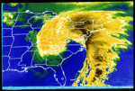
GFS Maxres Ensemble looks a lot like Euro snowfall maps- never heard of them
Radz- Pro Enthusiast

- Posts : 1028
Reputation : 17
Join date : 2013-01-12
Location : Cortlandt Manor NY
 Re: 01/22/16 - 01/23/16 Update #2 - Models Not Backing Off
wow, no posts in the last 25 minutes. The silence is deafening.

gigs68- Posts : 142
Reputation : 3
Join date : 2013-01-16
Location : Commack, NY (NW Suffolk)
 Re: 01/22/16 - 01/23/16 Update #2 - Models Not Backing Off
Wow, I met with a client and came back to 3 pages of a terrible euro run, and now other ensembles and ukmet may be trending that way. Wow, not going to banter here but this is just not good. No one is going to sleep tonight wondering what the euro will show.

jmanley32- Senior Enthusiast

- Posts : 20646
Reputation : 108
Join date : 2013-12-12
Age : 43
Location : Yonkers, NY
 Re: 01/22/16 - 01/23/16 Update #2 - Models Not Backing Off
did the euro use the data from the storm coming on shore?

weatherwatchermom- Senior Enthusiast

- Posts : 3895
Reputation : 78
Join date : 2014-11-25
Location : Hazlet Township, NJ
 Re: 01/22/16 - 01/23/16 Update #2 - Models Not Backing Off
jmanley32 wrote:Wow, I met with a client and came back to 3 pages of a terrible euro run, and now other ensembles and ukmet may be trending that way. Wow, not going to banter here but this is just not good. No one is going to sleep tonight wondering what the euro will show.
Cant really help it the way this winter has gone. We're all emotionally unstable and should probably seek professional attention... Gotta love a snowless winter and potential major storm where models are playing their bs games with us, not a good time but I think most of us expected it as some point deep down.

NjWeatherGuy- Advanced Forecaster

- Posts : 4100
Reputation : 28
Join date : 2013-01-06
Location : Belle Mead, NJ
 Re: 01/22/16 - 01/23/16 Update #2 - Models Not Backing Off
jimv45 wrote:Hyde I was happy when i saw the GFS for everybody now this!!! the winter of 2015 2016 is just so frustrating!!!!! got to remain positive!!
I want to remain positive but that Euro run is very concerning. We probably get 2 inches or less from that run.

hyde345- Pro Enthusiast

- Posts : 1084
Reputation : 48
Join date : 2013-01-08
Location : Hyde Park, NY
 Re: 01/22/16 - 01/23/16 Update #2 - Models Not Backing Off
Frank_Wx wrote:Wow - EURO and GFS models are in agreement. H5 closes off over TN 18z Friday. Where they differ is the EURO occludes the H5 low once it closes off, while the GFS continues taking it east-northeast. On the EURO, it almost looks as if the western ridge is collapsing on top of the mean vort, while the GFS flattens the ridge and the vort rides the flow. I can't sit here and say which one is right, but doesn't the EURO stalling the H5 low over TN to then track it east-southeast makes less sense than what the GFS does?
I can't get H5 vorticity on my site for the Euro, but I *think* that I might know what the difference is. If you look when the ridge starts to fold over, there is a secondary short wave that actually causes it. Now, seeing as though I can only get H5 heights and not vorticity for the Euro, it looks to me like the Euro is modeling that second shortwave that crashes the top of the ridge over to be much stronger than the GFS. This causes a near wave-break event, but can't quite get there completely. However, it forces enough ridging over top of the trough to keep it suppressed, and doesn't allow it to turn the corner. The GFS on the other hand, has a weaker secondary, which although still works to collapse the peak of the ridge, is not nearly enough to get it to partially roll over the deepening eastern trough. Instead, it just shears whatever energy was there and consolidates it with the rest of the flow. Can you confirm?
rb924119- Meteorologist

- Posts : 7112
Reputation : 195
Join date : 2013-02-06
Age : 32
Location : Greentown, Pa
 Re: 01/22/16 - 01/23/16 Update #2 - Models Not Backing Off
Our storm isn't even on shore yet. We have had high hopes for days for energy that is in the Northern Pacific. Patience. This is ONE run.
dsix85- Pro Enthusiast

- Posts : 351
Reputation : 8
Join date : 2014-01-01
Location : New York
 Re: 01/22/16 - 01/23/16 Update #2 - Models Not Backing Off
Unprecidented agreement is not really true atm. Lets hope the Euro comes back with a vengeance it has before.

jmanley32- Senior Enthusiast

- Posts : 20646
Reputation : 108
Join date : 2013-12-12
Age : 43
Location : Yonkers, NY
 Re: 01/22/16 - 01/23/16 Update #2 - Models Not Backing Off
rb924119 wrote:Frank_Wx wrote:Wow - EURO and GFS models are in agreement. H5 closes off over TN 18z Friday. Where they differ is the EURO occludes the H5 low once it closes off, while the GFS continues taking it east-northeast. On the EURO, it almost looks as if the western ridge is collapsing on top of the mean vort, while the GFS flattens the ridge and the vort rides the flow. I can't sit here and say which one is right, but doesn't the EURO stalling the H5 low over TN to then track it east-southeast makes less sense than what the GFS does?
I can't get H5 vorticity on my site for the Euro, but I *think* that I might know what the difference is. If you look when the ridge starts to fold over, there is a secondary short wave that actually causes it. Now, seeing as though I can only get H5 heights and not vorticity for the Euro, it looks to me like the Euro is modeling that second shortwave that crashes the top of the ridge over to be much stronger than the GFS. This causes a near wave-break event, but can't quite get there completely. However, it forces enough ridging over top of the trough to keep it suppressed, and doesn't allow it to turn the corner. The GFS on the other hand, has a weaker secondary, which although still works to collapse the peak of the ridge, is not nearly enough to get it to partially roll over the deepening eastern trough. Instead, it just shears whatever energy was there and consolidates it with the rest of the flow. Can you confirm?
Yes, it took me awhile to notice that but I do now. The northern s/w is basically shearing out the NW side of the trough.
_________________
_______________________________________________________________________________________________________
CLICK HERE to view NJ Strong Snowstorm Classifications
 Re: 01/22/16 - 01/23/16 Update #2 - Models Not Backing Off
dsix85 wrote:Our storm isn't even on shore yet. We have had high hopes for days for energy that is in the Northern Pacific. Patience. This is ONE run.
I though the 00Z run was trending south and east also. If it wasn't the Euro I wouldn't be as concerned but it is and this model has shown in the past that it picks up on subtleties quicker than other models and then they play catch up. I hope this is not the case but I'm worried.

hyde345- Pro Enthusiast

- Posts : 1084
Reputation : 48
Join date : 2013-01-08
Location : Hyde Park, NY
 Re: 01/22/16 - 01/23/16 Update #2 - Models Not Backing Off
The 12z EPS are out. They are north and west of the OP but south of last night's run. They are about 75 miles further north with the H5 low compared to the OP. Overall, it's about 5-10" of snow for the area on the EURO Ensembles.
_________________
_______________________________________________________________________________________________________
CLICK HERE to view NJ Strong Snowstorm Classifications
 Re: 01/22/16 - 01/23/16 Update #2 - Models Not Backing Off
This model is as useless as the NAM but it is in the GFS camp. This is the FIM.


_________________
_______________________________________________________________________________________________________
CLICK HERE to view NJ Strong Snowstorm Classifications
Page 20 of 29 •  1 ... 11 ... 19, 20, 21 ... 24 ... 29
Page 20 of 29
Permissions in this forum:
You cannot reply to topics in this forum
 Home
Home